Projet logements
Projet logements is in Le Chesnay-Rocquencourt, Arrondissement of Versailles, Île-de-France. Projet logements is situated nearby to the health club keepcool, as well as near the amusement arcade Jeux Alda.| Tap on a place to explore it |
Places of Interest Nearby
Highlights include Hôtel de Ville, Le Chesnay and Église Notre-Dame-de-la-Résurrection du Chesnay.
Hôtel de Ville, Le Chesnay
Town hall
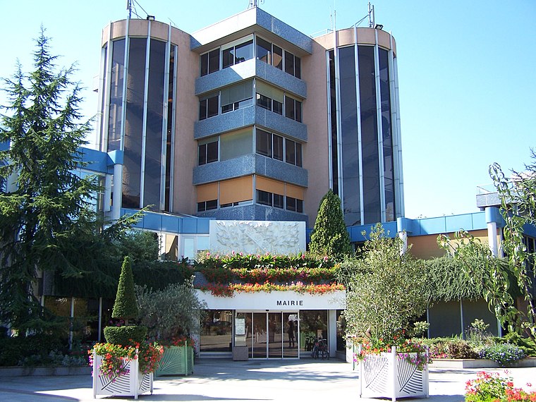
Photo: Henrysalome, CC BY-SA 3.0.
The Hôtel de Ville is a municipal building in Le Chesnay, Yvelines, in the western suburbs of Paris, standing on Rue Pottier. Hôtel de Ville, Le Chesnay is situated 430 metres northwest of Projet logements.
Église Notre-Dame-de-la-Résurrection du Chesnay
Church

Photo: Henrysalome, CC BY-SA 3.0.
Église Notre-Dame-de-la-Résurrection du Chesnay is a church, which is situated 450 metres northwest of Projet logements.
Château de Bellevue
Castle

Photo: Wikimedia, Public domain.
Château de Bellevue is a castle, which is situated 720 metres southeast of Projet logements.
Places in the Area
Nearby places include Le Chesnay and Le Chesnay-Rocquencourt.
Le Chesnay
Suburb
Photo: Henrysalome, CC BY-SA 3.0.
Le Chesnay is a former commune in the Yvelines department in the Île-de-France region in north-central France. On 1 January 2019, it was merged into the new commune Le Chesnay-Rocquencourt.
Le Chesnay-Rocquencourt
Town
Photo: Henrysalome, CC BY-SA 3.0.
Le Chesnay-Rocquencourt is a commune in the western suburbs of Paris, in the department of Yvelines. It was established on 1 January 2019 from the amalgamation of the communes of Le Chesnay and Rocquencourt.
Hameau de la Reine
Locality

Photo: Daderot, CC BY-SA 3.0.
The Hameau de la Reine is a rustic retreat in the park of the Château de Versailles built for Marie Antoinette in 1783 near the Petit Trianon in Yvelines, France.
Projet logements
Latitude
48.82297° or 48° 49′ 23″ northLongitude
2.12789° or 2° 7′ 40″ eastOpen location code
8FW4R4FH+55OpenStreetMap ID
way 1219345860OpenStreetMap feature
landuse=construction
This page is based on OpenStreetMap, Wikidata, and Wikimedia Commons.
We’d love your help improving our open data sources. Thank you for contributing.
Satellite Map
Discover Projet logements from above in high-definition satellite imagery.
Notable Places Nearby
Highlights include keepcool and Jeux Alda.
Nearby Places
Explore places such as Kaufman Broad and Redingote.
Île-de-France: Must-Visit Destinations
Delve into Paris, Versailles, Boulogne-Billancourt, and Paris Charles de Gaulle Airport.
Curious Places to Discover
Uncover intriguing places from every corner of the globe.
About Mapcarta. Data © OpenStreetMap contributors and available under the Open Database License". Text is available under the CC BY-SA 4.0 license, except for photos, directions, and the map. Photo: Inkey, CC BY-SA 3.0.