Malteser Hilfedienst gGmbH
Malteser Hilfedienst gGmbH is a social service facility in Karlsruhe, Rhine-Neckar, Baden-Württemberg which is located on Herrmann-Leichtlin-Straße. Malteser Hilfedienst gGmbH is situated nearby to the church Treffpunkt Leben, as well as near the bus stop Hornisgrindestraße.| Tap on a place to explore it |
Places of Interest Nearby
Highlights include Karlsruhe West station and ZKM Center for Art and Media Karlsruhe.
Karlsruhe West station
Railway station
 Karlsruhe West station is a railway station in the Grünwinkel district in the municipality of Karlsruhe, located in Baden-Württemberg, Germany. Karlsruhe West station is situated 620 metres north of Malteser Hilfedienst gGmbH.
ZKM Center for Art and Media Karlsruhe
Arts center

Photo: JOEXX, CC BY-SA 3.0.
The ZKM | Center for Art and Media Karlsruhe, a cultural institution, was founded in 1989 and, since 1997, is located in a former munitions factory in Karlsruhe, Germany. ZKM Center for Art and Media Karlsruhe is situated 2 km east of Malteser Hilfedienst gGmbH.
Europahalle
Stadium
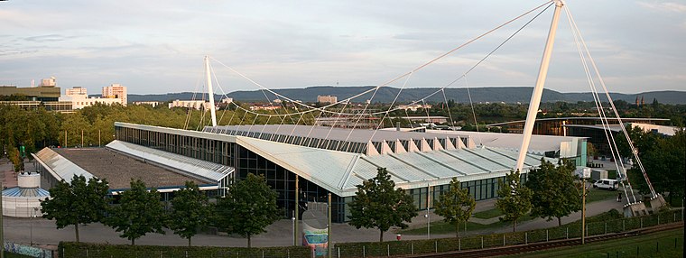
Photo: Bough, CC BY-SA 2.0 de.
Europahalle is an indoor sporting arena located in Karlsruhe, Germany. The capacity of the arena is 9,000 people. The venue has featured a number of world record performances in athletics, including a jump of 2.07 m in the high jump by Heike Henkel in 1992, when the Europahalle hosted the German Indoor Championships. Europahalle is situated 1¼ km east of Malteser Hilfedienst gGmbH.
Places in the Area
Nearby places include Mühlburg and Rheinstetten.
Mühlburg
Suburb

Photo: Baden-Paul, CC0.
Mühlburg is a district of Karlsruhe, Germany. The district is further divided into Alt-Mühlburg, Weingärtensiedlung, Rheinhafen and Mühlburger Feld.
Rheinstetten
Town

Photo: DALIBRI, CC BY-SA 4.0.
Rheinstetten is a town in the west of Baden-Württemberg on the border to Rhineland-Palatinate. It is situated to the south-west of Karlsruhe and belongs to the rural district of Karlsruhe. Rheinstetten is situated 5 km southwest of Malteser Hilfedienst gGmbH.
Neureut
Suburb
Neureut is the northernmost district of Karlsruhe, Germany. It was the most populous rural community of Baden-Württemberg before being incorporated into Karlsruhe on February 14, 1975. Neureut is situated 6 km north of Malteser Hilfedienst gGmbH.
Malteser Hilfedienst gGmbH
- Type: Social service facility
- Address: Herrmann-Leichtlin-Straße 13, Karlsruhe, 76185
- Category: building
- Location: Karlsruhe, Karlsruhe Region, Rhine-Neckar, Baden-Württemberg, Germany, Central Europe, Europe
- View on OpenStreetMap
Latitude
48.99718° or 48° 59′ 50″ northLongitude
8.35974° or 8° 21′ 35″ eastOpen location code
8FWCX9W5+VVOpenStreetMap ID
way 122164617OpenStreetMap feature
amenity=social_facilityOpenStreetMap feature
building=yes
This page is based on OpenStreetMap, Wikidata, and Wikimedia Commons.
We’d love your help improving our open data sources. Thank you for contributing.
Satellite Map
Discover Malteser Hilfedienst gGmbH from above in high-definition satellite imagery.
Notable Places Nearby
Highlights include Treffpunkt Leben and Hornisgrindestraße.
Nearby Places
Explore places such as Rettungswache Malteser and Emir Automobile.
Rhine-Neckar: Must-Visit Destinations
Delve into Heidelberg, Mannheim, Heilbronn, and Sinsheim.
Curious Social Service Facilities to Discover
Uncover intriguing social service facilities from every corner of the globe.
About Mapcarta. Data © OpenStreetMap contributors and available under the Open Database License". Text is available under the CC BY-SA 4.0 license, except for photos, directions, and the map. Photo: Ruhrfisch, CC BY-SA 3.0.