terrain de sport du village
terrain de sport du village is a playground in Jodoigne, Arrondissement of Nivelles, Wallonia. terrain de sport du village is situated nearby to the community center Salle de Village Le Maka, as well as near the public building Ancienne école communale.| Tap on a place to explore it |
Places of Interest Nearby
Highlights include La Ramée Abbey and Tumulus of Glimes.
La Ramée Abbey
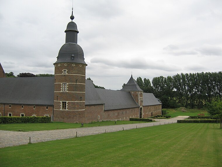
Photo: Grentidez, Public domain.
La Ramée Abbey is situated 1 km southeast of terrain de sport du village.
Tumulus of Glimes
Archaeological site

Photo: Varech, CC BY-SA 3.0.
Tumulus of Glimes is an archaeological site, which is situated 1¼ km southwest of terrain de sport du village.
Opprebais Castle

Photo: Varech, Public domain.
Opprebais Castle is a 13th-century fortified farmhouse in Opprebais, Wallonia, in the municipality of Incourt, Walloon Brabant, Belgium. Opprebais Castle is situated 3½ km west of terrain de sport du village.
Places in the Area
Nearby places include Jodoigne-Souveraine and Incourt.
Jodoigne-Souveraine
Village

Photo: Anakil, CC BY-SA 4.0.
Jodoigne-Souveraine is a village of Wallonia and a district of the municipality of Jodoigne, located in the province of Walloon Brabant, Belgium. The village lies next to the Great Gette. Jodoigne-Souveraine is situated 2½ km north of terrain de sport du village.
Incourt
Village

Photo: Jean-Pol GRANDMONT, CC BY 3.0.
Incourt is a municipality of Wallonia located in the Belgian province of Walloon Brabant. On January 1, 2006, Incourt had a total population of 4,585. The total area is 38.79 km² which gives a population density of 118 inhabitants per km². Incourt is situated 3 km west of terrain de sport du village.
Mont-Saint-André
Village

Photo: Sonuwe, CC BY-SA 3.0.
Mont-Saint-André is a village, which is situated 3½ km south of terrain de sport du village.
terrain de sport du village
- Type: Playground
- Category: recreation area
- Location: Jodoigne, Arrondissement of Nivelles, Walloon Brabant, Wallonia, Belgium, Benelux, Europe
- View on OpenStreetMap
Latitude
50.68598° or 50° 41′ 10″ northLongitude
4.84408° or 4° 50′ 39″ eastOpen location code
9F26MRPV+9JOpenStreetMap ID
way 1230353857OpenStreetMap feature
leisure=playground
This page is based on OpenStreetMap, Wikidata, and Wikimedia Commons.
We’d love your help improving our open data sources. Thank you for contributing.
Satellite Map
Discover terrain de sport du village from above in high-definition satellite imagery.
Notable Places Nearby
Highlights include Salle de Village Le Maka and Ancienne école communale.
Nearby Places
Explore places such as Presbytère and Ancienne forge.
Walloon Brabant: Must-Visit Destinations
Delve into Waterloo, Villers-la-Ville, and Louvain-la-Neuve.
Curious Playgrounds to Discover
Uncover intriguing playgrounds from every corner of the globe.
About Mapcarta. Data © OpenStreetMap contributors and available under the Open Database License". Text is available under the CC BY-SA 4.0 license, except for photos, directions, and the map. Photo: Myrabella, CC BY-SA 3.0.