HY Bel Air
HY Bel Air is a building in L’Haÿ-les-Roses, Val-de-Marne, Île-de-France. HY Bel Air is situated nearby to the government office Ateliers Municipaux, as well as near the garden Carrefour des Cultures.| Tap on a place to explore it |
Places of Interest Nearby
Highlights include Institut Gustave Roussy and Villejuif–Gustave Roussy station.
Institut Gustave Roussy
Hospital

Photo: Chabe01, CC BY-SA 4.0.
Institut Gustave Roussy, sometimes called Gustave Roussy, is a cancer research hospital in Europe. It is located near Paris. It is named after Gustave Roussy, a Swiss-French neuropathologist. Institut Gustave Roussy is situated 1¼ km north of HY Bel Air.
Villejuif–Gustave Roussy station
Railway station

Photo: Chabe01, CC BY-SA 4.0.
Villejuif–Gustave Roussy is an underground station on Line 14 and Line 15 of the Paris Métro. It is part of the Grand Paris Express project. The station is located in the town of Villejuif near the Institut Gustave Roussy, hence its name. Villejuif–Gustave Roussy station is situated 1 km northeast of HY Bel Air.
Parc départemental des Hautes-Bruyères
Park

Photo: besopha, CC BY-SA 2.0.
Parc départemental des Hautes-Bruyères is a park, which is situated 660 metres northeast of HY Bel Air.
Places in the Area
Nearby places include Cachan and Chevilly-Larue.
Cachan
Town

Photo: Damien94, Public domain.
Cachan is a commune in the southern suburbs of Paris, France. It is located 6.7 km from the center of Paris. The prestigious École Spéciale des Travaux Publics is located there.
Chevilly-Larue
Town

Photo: Valentin Ottone, CC BY 2.0.
Chevilly-Larue is a commune in the southern suburbs of Paris, France. It is located 9.3 km from the center of Paris.
Villejuif
Town
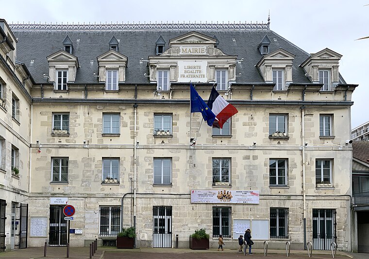
Photo: Chabe01, CC BY-SA 4.0.
Villejuif is a commune in the southern suburbs of Paris, France. It is located 7 km from the centre of Paris.
HY Bel Air
- Type: Building
- Roof shape: gabled
- Location: L’Haÿ-les-Roses, Arrondissement of L’Haÿ-les-Roses, Val-de-Marne, Île-de-France, France, Europe
- View on OpenStreetMap
Latitude
48.78497° or 48° 47′ 6″ northLongitude
2.34344° or 2° 20′ 36″ eastOperator
EnedisOpen location code
8FW4Q8MV+X9OpenStreetMap ID
way 124257077OpenStreetMap feature
building=serviceOpenStreetMap attribute
roof-shape=gabled
This page is based on OpenStreetMap, Wikidata, and Wikimedia Commons.
We’d love your help improving our open data sources. Thank you for contributing.
Satellite Map
Discover HY Bel Air from above in high-definition satellite imagery.
Notable Places Nearby
Highlights include Ateliers Municipaux and France Travail.
Nearby Places
Explore places such as Carrefour and Dr J. Laurent-Gonnet.
Île-de-France: Must-Visit Destinations
Delve into Paris, Versailles, Boulogne-Billancourt, and Paris Charles de Gaulle Airport.
Curious Buildings to Discover
Uncover intriguing buildings from every corner of the globe.
About Mapcarta. Data © OpenStreetMap contributors and available under the Open Database License". Text is available under the CC BY-SA 4.0 license, except for photos, directions, and the map. Photo: Guillaume Baviere, CC BY 2.0.