Nailers Arms
Nailers Arms is a pub in Bournheath, Bromsgrove District, England. Nailers Arms is situated nearby to the village Bournheath, as well as near the recreation area Bourneheath Recreation Ground.| Tap on a place to explore it |
Places of Interest Nearby
Highlights include Christ Church and Church of the Holy Trinity and St Mary.
Christ Church
Church

Photo: Chris McMillan, CC BY-SA 2.0.
Christ Church is situated 3,500 feet east of Nailers Arms.
Church of the Holy Trinity and St Mary
Church

Photo: Richard Greenwood, CC BY-SA 2.0.
Church of the Holy Trinity and St Mary is situated 1¼ miles southwest of Nailers Arms.
Artrix
Arts center
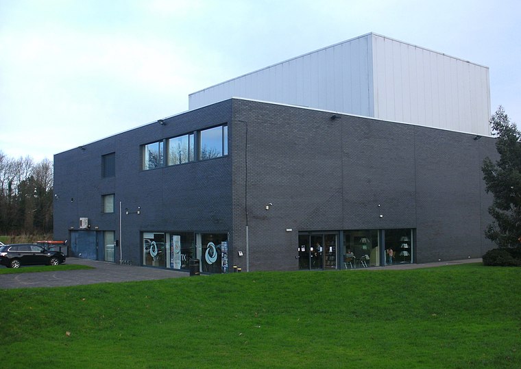
Photo: PicturePrince, CC BY-SA 4.0.
Artrix is an arts venue in Bromsgrove, England, located on School Drive just outside the town centre. The building was constructed between 2004 and 2005 on a green field site sold off by the Heart of Worcestershire College Bromsgrove campus in 1999 and the Bromsgrove 'Blue Light' centre. Artrix is situated 2 miles southeast of Nailers Arms.
Places in the Area
Nearby places include Bournheath and Fairfield.
Bournheath
Village

Photo: P L Chadwick, CC BY-SA 2.0.
Bournheath is a village and civil parish in the Bromsgrove District of Worcestershire, England, about three miles north of Bromsgrove. According to the 2001 census it had a population of 454.
Fairfield
Village

Photo: Geoff Gartside, CC BY-SA 2.0.
Fairfield is a village in the district of Bromsgrove, Worcestershire, England. It is in the civil parish of Belbroughton. The village of Fairfield and the hamlets of Stoneybridge & Wildmoor form the Fairfield Ward, part of Belbroughton and Fairfield Parish, which is in Bromsgrove District, Worcestershire.
Catshill
Village

Photo: Roy Hughes, CC BY-SA 2.0.
Catshill is a village in the civil parish of Catshill and North Marlbrook, in the Bromsgrove district, in Worcestershire, England, about 3 miles north of Bromsgrove and 10 miles south-west of Birmingham.
Nailers Arms
- Type: Pub
- Category: building
- Location: Bournheath, Bromsgrove District, Worcestershire, West Midlands, England, United Kingdom, Britain and Ireland, Europe
- View on OpenStreetMap
Latitude
52.36463° or 52° 21′ 53″ northLongitude
-2.07972° or 2° 4′ 47″ westOpen location code
9C4V9W7C+V4OpenStreetMap ID
way 1246128066OpenStreetMap feature
amenity=pubOpenStreetMap feature
building=yes
This page is based on OpenStreetMap, Wikidata, and Wikimedia Commons.
We’d love your help improving our open data sources. Thank you for contributing.
Satellite Map
Discover Nailers Arms from above in high-definition satellite imagery.
Notable Places Nearby
Highlights include Bourneheath Recreation Ground and Bromsgrove Cemetery.
Nearby Places
Explore places such as The Gate and Bournheath- Doctors Hill.
Worcestershire: Must-Visit Destinations
Delve into Worcester, Redditch, Kidderminster, and Evesham.
Curious Pubs to Discover
Uncover intriguing pubs from every corner of the globe.
About Mapcarta. Data © OpenStreetMap contributors and available under the Open Database License". Text is available under the CC BY-SA 4.0 license, except for photos, directions, and the map. Photo: brianac37, CC BY 2.0.