Župnjišče Strunjan
Župnjišče Strunjan is a building in Piran, Coast and Karst. Župnjišče Strunjan is situated nearby to Church of the Apparition of the Virgin Mary, Strunjan, as well as near the peak Punta.| Tap on a place to explore it |
Places of Interest Nearby
Highlights include Church of the Apparition of the Virgin Mary, Strunjan and Strunjan Natural Park.

Strunjan Natural Park
Nature reserve

Photo: Zorka Sojka, CC BY-SA 4.0.
Strunjan Natural Park is a nature reserve.
Tartini Square
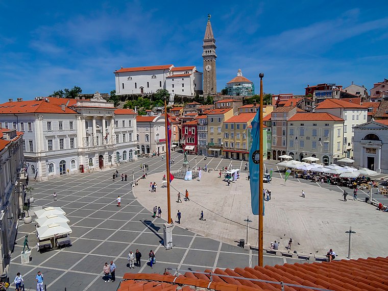
Photo: Grega Pirc, CC BY 3.0.
Tartini Square is the largest and main town square in Piran, Slovenia. It was named after violinist and composer Giuseppe Tartini, of whom a monument was made in 1896. Tartini Square is situated 3 km west of Župnjišče Strunjan.
Places in the Area
Nearby places include Strunjan and Dobrava.
Strunjan
Village

Photo: Wikimedia, CC BY-SA 3.0.
Strunjan is a settlement in the Municipality of Piran in the Littoral region of Slovenia.
Dobrava
Village
Dobrava is a settlement on the Adriatic coast in the Municipality of Izola in the Littoral region of Slovenia. The Belvedere tourist resort and camping are nearby.

Župnjišče Strunjan
- Type: Building
- Location: Piran, Coast and Karst, Slovenia, Central Europe, Europe
- View on OpenStreetMap
Latitude
45.53513° or 45° 32′ 7″ northLongitude
13.60766° or 13° 36′ 28″ eastOpen location code
8FQMGJP5+33OpenStreetMap ID
way 1248934881OpenStreetMap feature
building=yes
This page is based on OpenStreetMap, Wikidata, and Wikimedia Commons.
We’d love your help improving our open data sources. Thank you for contributing.
Satellite Map
Discover Župnjišče Strunjan from above in high-definition satellite imagery.
Notable Places Nearby
Highlights include Punta and JusThys.
Nearby Places
Explore places such as Stealla Maris - Pastoralni dom and Plaža Mesečev Zaliv.
Coast and Karst: Must-Visit Destinations
Delve into Koper, Nova Gorica, Postojna, and Izola.
Curious Buildings to Discover
Uncover intriguing buildings from every corner of the globe.
About Mapcarta. Data © OpenStreetMap contributors and available under the Open Database License". Text is available under the CC BY-SA 4.0 license, except for photos, directions, and the map. Photo: Dimitry Anikin, CC BY 2.0.