The Grange
The Grange is a park in Birmingham, England. The Grange is situated nearby to the hospital John Taylor Hospice, as well as near the sports venue Yenton Fields.| Tap on a place to explore it |
Places of Interest Nearby
Highlights include Erdington Library and Erdington Abbey.
Erdington Library
Library

Photo: Simonxag, Public domain.
Erdington Library is situated 2,600 feet west of The Grange.
Erdington Abbey
Church
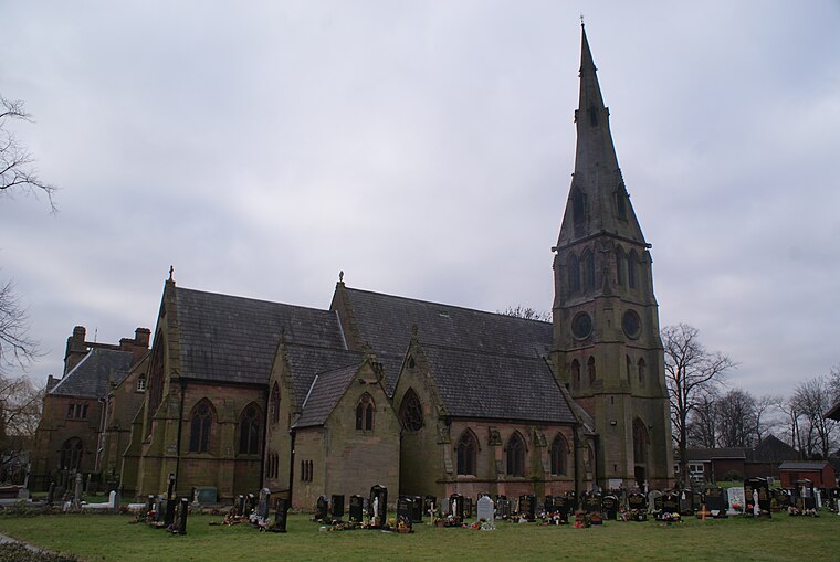
Photo: Voice of Clam, Public domain.
Erdington Abbey Church on Sutton Road, Erdington, Birmingham, England, is the more usual name of the grade II listed church of Saints Thomas and Edmund of Canterbury. Erdington Abbey is situated 2,700 feet west of The Grange.
St Edmund Campion Catholic School
School
St Edmund Campion Catholic School is a coeducational Catholic secondary school and sixth form located on the corner of Holly Lane and Sutton New Road in the Erdington area of Birmingham, England. St Edmund Campion Catholic School is situated 2,000 feet northwest of The Grange.
Places in the Area
Nearby places include Erdington and Birches Green.
Erdington
Suburb

Photo: Voice of Clam, Public domain.
Erdington is a suburb and ward of Birmingham, in the county of the West Midlands, England. It is located 5 miles northeast of central Birmingham, bordering Sutton Coldfield.
Birches Green
Hamlet
Birches Green is a small area of Tyburn in Birmingham, England, within the parliamentary constitiuency of Erdington. It is located between Gravelly Hill, Erdington and the M6 motorway.
Tyburn
Village

Photo: Roy Hughes, CC BY-SA 2.0.
Tyburn is a ward in Birmingham, in the county of West Midlands, England formerly known as Kingsbury. It is part of the Erdington formal district and comprises Castle Vale, Fort Parkway in Castle Bromwich, the Pype Hayes area of Erdington, Birches Green and Tyburn Road.
The Grange
- Type: Park
- Category: recreation area
- Location: Birmingham, England, United Kingdom, Britain and Ireland, Europe
- View on OpenStreetMap
Latitude
52.52608° or 52° 31′ 34″ northLongitude
-1.8248° or 1° 49′ 29″ westOperator
Birmingham City CouncilOpen location code
9C4WG5GG+C3OpenStreetMap ID
way 1250383567OpenStreetMap feature
leisure=park
This page is based on OpenStreetMap, Wikidata, and Wikimedia Commons.
We’d love your help improving our open data sources. Thank you for contributing.
Satellite Map
Discover The Grange from above in high-definition satellite imagery.
Places with the Same Name
Discover other places named “The Grange”.
Notable Places Nearby
Highlights include John Taylor Hospice and Yenton Fields.
Nearby Places
Explore places such as Grange Rd / Playing Field and Holly Lane / Moor End Lane.
England: Must-Visit Destinations
Delve into London, Manchester, Sheffield, and Leeds.
Curious Parks to Discover
Uncover intriguing parks from every corner of the globe.
About Mapcarta. Data © OpenStreetMap contributors and available under the Open Database License". Text is available under the CC BY-SA 4.0 license, except for photos, directions, and the map. Photo: sidibousaid, CC BY 2.0.