Former cow shed
Former cow shed is a building in Speldhurst, Tunbridge Wells District, England. Former cow shed is situated nearby to Langton Green Primary School, as well as near the community center Langton Green Village Hall.| Tap on a place to explore it |
Places of Interest Nearby
Highlights include Rusthall Library and Church of St Peter.
Rusthall Library
Library

Photo: Nigel Chadwick, CC BY-SA 2.0.
Rusthall Library is situated 1¼ miles east of Former cow shed.
Church of St Peter
Church

Photo: The Voice of Hassocks, CC0.
Church of St Peter is situated 1 mile west of Former cow shed.
Holmewood House School
School
Holmewood House School is an IAPS independent, co-educational preparatory school for boys and girls aged 3–13, in Langton Green, near Tunbridge Wells, Kent. The building is a Decimus Burton mansion, originally called Mitchells, rebuilt in 1837 after a fire. Holmewood House School is situated 1 mile southeast of Former cow shed.
Places in the Area
Nearby places include Langton Green and Speldhurst.
Langton Green
Village
Langton Green is a village in the borough of Tunbridge Wells, England, lying around two miles west of the town centre along the A264. It is located within the parish of Speldhurst although it has its own church on the village green—the Grade II*-listed All Saints, built in 1862–63 by George Gilbert Scott.
Speldhurst
Village
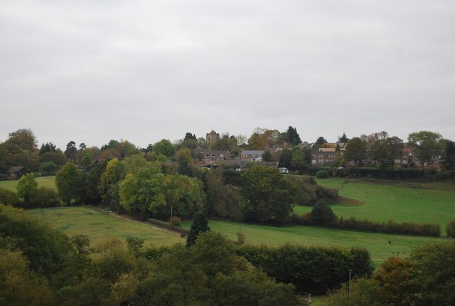
Photo: Nigel Chadwick, CC BY-SA 2.0.
Speldhurst is a village and civil parish in the borough of Tunbridge Wells in Kent, England. The parish is to the west of Tunbridge Wells: the village is 3 miles west of the town.
Groombridge
Village

Photo: Mrfinch, CC BY-SA 3.0.
Groombridge is a village of about 1,600 people. It straddles the border between Kent and East Sussex, in England. The nearest large town is Royal Tunbridge Wells, about 4.5 miles away by road. Groombridge is situated 2 miles southwest of Former cow shed.
Former cow shed
Latitude
51.13704° or 51° 8′ 13″ northLongitude
0.20229° or 0° 12′ 8″ eastOpen location code
9F3246P2+RWOpenStreetMap ID
way 1259773717OpenStreetMap feature
building=yes
This page is based on OpenStreetMap, Wikidata, and Wikimedia Commons.
We’d love your help improving our open data sources. Thank you for contributing.
Satellite Map
Discover Former cow shed from above in high-definition satellite imagery.
Notable Places Nearby
Highlights include Langton Green Primary School and Langton Green Village Hall.
Nearby Places
Explore places such as Ashurst Place and Langton Hare.
Kent: Must-Visit Destinations
Delve into Canterbury, Dover, Maidstone, and Rochester.
Curious Buildings to Discover
Uncover intriguing buildings from every corner of the globe.
About Mapcarta. Data © OpenStreetMap contributors and available under the Open Database License". Text is available under the CC BY-SA 4.0 license, except for photos, directions, and the map. Photo: Diliff, CC BY-SA 3.0.