Lucky Liquor Store
Lucky Liquor Store is a liquor store in Caddo, Louisiana which is located on Christian Street. Lucky Liquor Store is situated nearby to the garden Shreveport Green Urban Farm, as well as near Mt. Moriah Baptist Church.| Tap on a place to explore it |
- Opening hours: Monday—Thursday 10:00 AM—9:00 PM and Friday 11:00 AM—9:00 PM and Saturday 11:00 AM—9:30 PM
- Type: Liquor store
- Address: 161 Christian Street, Shreveport, LA 71101
Places of Interest Nearby
Highlights include Robinson Film Center and Long–Allen Bridge.
Robinson Film Center
Movie theater

Photo: Billy Hathorn, CC BY-SA 3.0.
Robinson Film Center is a movie theater, which is situated 2,100 feet east of Lucky Liquor Store.
Long–Allen Bridge
Bridge
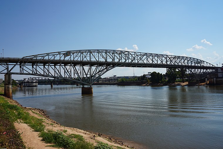
Photo: Michael Barera, CC BY-SA 4.0.
The Long–Allen Bridge is a truss bridge in Louisiana, named for Louisiana governors Huey Long and Oscar K. Allen. It connects Bossier City, Louisiana in Bossier Parish with Shreveport in Caddo Parish. Long–Allen Bridge is situated 1 mile northeast of Lucky Liquor Store.
Shreveport Downtown Airport
Aerodrome
Shreveport Downtown Airport is a public use airport located in the Caddo Parish portion of Shreveport, Louisiana, United States. It is closer to downtown Shreveport than the larger Shreveport Regional Airport. It is owned by the Shreveport Airport Authority. Shreveport Downtown Airport is situated 2 miles north of Lucky Liquor Store.
Places in the Area
Nearby places include Shreveport and Bossier City.
Shreveport
 Shreveport is the largest city in Northern Louisiana, part of the twin city metro of Shreveport-Bossier City, and is considered the principal city in the three-state region known as the "Ark-La-Tex." It has about 188,000 residents, and is in the area of the state designated as the Sportsman's Paradise.
Bossier City
Photo: Michael Barera, CC BY-SA 4.0.
Bossier City is the second-largest city in Northern Louisiana and the largest city in Bossier Parish. Home to Barksdale Air Force Base, which hosts several Air Force commands, as well as the backup landing site of Air Force One, Bossier City's recent history revolves largely around the U.S. military.
Lucky Liquor Store
- Categories: building, shop, and commercial building
- Location: Caddo, Louisiana, South, United States, North America
- View on OpenStreetMap
Latitude
32.51013° or 32° 30′ 37″ northLongitude
-93.75743° or 93° 45′ 27″ westLevels
1Height
13 feet (4 metres)Open location code
8648G66V+32OpenStreetMap ID
way 1262403310OpenStreetMap feature
building=commercialOpenStreetMap feature
shop=alcohol
This page is based on OpenStreetMap, Wikidata, and Wikimedia Commons.
We’d love your help improving our open data sources. Thank you for contributing.
Satellite Map
Discover Lucky Liquor Store from above in high-definition satellite imagery.
Notable Places Nearby
Highlights include Shreveport Green Urban Farm and Mt. Moriah Baptist Church.
Nearby Places
Explore places such as G-Unit Film & Television Studio and Freeman & Harris Cafe.
Louisiana: Must-Visit Destinations
Delve into New Orleans, Baton Rouge, Shreveport, and Natchitoches Parish.
Curious Liquor Stores to Discover
Uncover intriguing liquor stores from every corner of the globe.
About Mapcarta. Data © OpenStreetMap contributors and available under the Open Database License". Text is available under the CC BY-SA 4.0 license, except for photos, directions, and the map. Photo: Wikimedia, CC BY-SA 2.0.