Fresno County Social Services
Fresno County Social Services is a social service facility in Fresno County, San Joaquin Valley, California. Fresno County Social Services is situated nearby to the police station Fresno County Sheriff’s, as well as near the recreation area Fresno County Fairgrounds.| Tap on a place to explore it |
Places of Interest Nearby
Highlights include Theodore Roosevelt High School and Santa Fe Passenger Depot.
Theodore Roosevelt High School
School
Theodore Roosevelt High School, is located in southeast Fresno, California. It is a high school established within the Fresno Unified School District. The high school mascot is the Rough Rider named after the 1st U.S. Theodore Roosevelt High School is situated 2,200 feet north of Fresno County Social Services.
Santa Fe Passenger Depot
Railway station
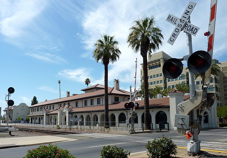 The Santa Fe Passenger Depot, also known as Fresno station, is an historic railroad station and transportation hub in downtown Fresno, California. It is served by Gold Runner inter-city passenger trains, Greyhound inter-city buses, and regional transit services including Fresno Area Express and the Fresno County Rural Transit Agency. Santa Fe Passenger Depot is situated 2 miles west of Fresno County Social Services.
Selland Arena
Stadium
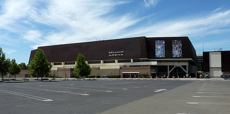 Selland Arena is a multi-purpose arena built in 1966 that makes up part of a four-venue complex of the Fresno Convention and Entertainment Center in Fresno, California. Selland Arena is situated 2 miles west of Fresno County Social Services.
Places in the Area
Nearby places include Cincotta and Calwa.
Cincotta
Locality
The Valley Division of the Atchison, Topeka and Santa Fe Railway ran from San Francisco to Barstow in California. It is currently in operation as the BNSF Railway's Stockton Subdivision and Bakersfield Subdivision. Cincotta is situated 2 miles north of Fresno County Social Services.
Calwa
Suburb
Calwa is an unincorporated community and census-designated place in Fresno County, California, United States. The population was 1,776 at the 2020 census, down from 2,052 at the 2010 census. Calwa is situated 2 miles south of Fresno County Social Services.
Fresno

Photo: David Jordan, CC BY-SA 3.0.
Fresno is in the San Joaquin Valley of California. Many visitors find themselves stopping in Fresno on the way to Yosemite National Park, Sequoia and Kings Canyon National Parks, or other destinations in the Sierras.
Fresno County Social Services
Latitude
36.73529° or 36° 44′ 7″ northLongitude
-119.75075° or 119° 45′ 3″ westOpen location code
8582P6PX+4POpenStreetMap ID
way 1262962507OpenStreetMap feature
amenity=social_facility
This page is based on OpenStreetMap, Wikidata, and Wikimedia Commons.
We’d love your help improving our open data sources. Thank you for contributing.
Satellite Map
Discover Fresno County Social Services from above in high-definition satellite imagery.
Notable Places Nearby
Highlights include Fresno County Sheriff’s and Fresno County Fairgrounds.
Nearby Places
Explore places such as County Social Services and Fresno County Department of Behavioral Health (DBH).
Fresno County: Must-Visit Destinations
Delve into Fresno, Clovis, Selma, and Reedley.
Curious Social Service Facilities to Discover
Uncover intriguing social service facilities from every corner of the globe.
About Mapcarta. Data © OpenStreetMap contributors and available under the Open Database License". Text is available under the CC BY-SA 4.0 license, except for photos, directions, and the map. Photo: Wikimedia, CC0.