Baths of Moctezuma
Baths of Moctezuma is an archaeological site in Mexico City, Central Mexico. Baths of Moctezuma is situated nearby to the theater building Foro Las Tazas, as well as near Los geandes Troncos.| Tap on a place to explore it |
Photo: Aarón Hdez, CC BY-SA 3.0.
Places of Interest Nearby
Highlights include Chapultepec and El Sargento.
Chapultepec

Photo: Ymblanter, CC BY-SA 3.0.
Chapultepec is a district of Mexico City. "Chapultepec" means "Grasshopper Hill" in Nahuatl, the language of the "Aztecs". The hill and surrounding district has much significance in Mexican history.
El Sargento

Photo: B.jars, CC BY-SA 4.0.
El Sargento is a Mexican cypress tree in Mexico City's park Chapultepec, planted by Nezahualcoyotl c. 1460. After living for approximately 500 years, the tree died in 1969, and its trunk stands today at around 50 feet tall. El Sargento is situated 200 metres north of Baths of Moctezuma.
National Museum of Anthropology
Museum
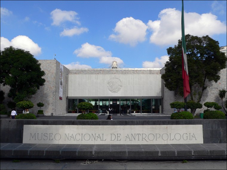
Photo: Wikimedia, CC BY-SA 3.0.
The National Museum of Anthropology is a national museum of Mexico. It is the largest and most visited museum in Mexico. Located in the area between Paseo de la Reforma and Mahatma Gandhi Street within Chapultepec Park in Mexico City, the museum contains… National Museum of Anthropology is situated 1 km northwest of Baths of Moctezuma.
Places in the Area
Nearby places include Condesa and San Miguel Chapultepec.
Condesa
Neighborhood

Photo: Keizers, CC BY-SA 3.0.
Condesa or La Condesa is an area in the Cuauhtémoc borough of Mexico City, south of Zona Rosa and 4 to 5 km west of the Zócalo, the city's main square.
San Miguel Chapultepec
Quarter

Photo: Wikimedia, CC BY-SA 2.0.
San Miguel Chapultepec is a colonia or neighborhood in Delegación Miguel Hidalgo in Mexico City. Its borders are: The colonia's streets carry the names of generals and governors of Mexico.
Little Seoul
Neighborhood
Pequeño Seúl is a Koreatown in Mexico City. Most of the city's Korean population lives in and around the Zona Rosa. According to the newspaper Reforma, there are at least 5,000 Koreans living in Zona Rosa and about 6,000 total in Colonia Juárez, the larger officially recognized neighborhood of which the Zona Rosa is a part of.
Baths of Moctezuma
- Type: Archaeological site
- Description: prehispanic water reservoir in Chapultepec, Mexico City
- Categories: waterhole, historic site, tourist attraction, and tourism
- Location: Mexico City, Central Mexico, Mexico, North America
- View on OpenStreetMap
Latitude
19.41763° or 19° 25′ 4″ northLongitude
-99.18144° or 99° 10′ 53″ westOpen location code
76F2CR99+3COpenStreetMap ID
way 1266261143OpenStreetMap feature
historic=archaeological_siteWikidata ID
Q136373087
This page is based on OpenStreetMap, Wikidata, and Wikimedia Commons.
We’d love your help improving our open data sources. Thank you for contributing.
Satellite Map
Discover Baths of Moctezuma from above in high-definition satellite imagery.
In Other Languages
“Baths of Moctezuma” goes by many names.
- Spanish: “Baños de Moctezuma”
Notable Places Nearby
Highlights include Foro Las Tazas and Los geandes Troncos.
Nearby Places
Explore places such as Monumento a los Héroes del Escuadrón 201 and La Templanza.
Mexico City: Must-Visit Destinations
Delve into Centro, Xochimilco, Coyoacán, and Condesa and Roma.
Curious Archaeological Sites to Discover
Uncover intriguing archaeological sites from every corner of the globe.
About Mapcarta. Data © OpenStreetMap contributors and available under the Open Database License". Text is available under the CC BY-SA 4.0 license, except for photos, directions, and the map. Photo: Aarón Hdez, CC BY-SA 3.0.