Arbour Vale School
Arbour Vale School is a school in Farnham Royal, South Bucks District, England. Arbour Vale School is situated nearby to Beechwood School, as well as near St Anthony’s Catholic Church.| Tap on a place to explore it |
- Type: School
- Description: school in Slough, UK
- Postal code: SL2 3AE
Places of Interest Nearby
Highlights include Beechwood School and The Duke’s Head Public House.
Beechwood School
School
Beechwood School is a coeducational secondary school and sixth form located in the Britwell area of Slough, Berkshire, England. The school was established in 1982 when the former Haymill and Warren Field Secondary schools merged on the Warren Field site. Beechwood School is situated 530 feet northwest of Arbour Vale School.
The Duke’s Head Public House
Pub

Photo: JThomas, CC BY-SA 2.0.
The Duke’s Head Public House is situated 1,000 feet northeast of Arbour Vale School.
Stoke Park
Manor estate
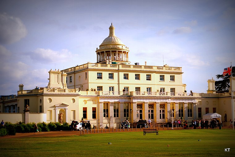
Photo: Carine06, CC BY-SA 2.0.
Stoke Park is a private sporting and leisure estate in Stoke Poges, Buckinghamshire. The mansion building is located in the middle of 300 acres of parkland, lakes, gardens and monuments. Stoke Park is situated 3,800 feet east of Arbour Vale School.
Places in the Area
Nearby places include Farnham Royal and Britwell.
Farnham Royal
Village

Photo: David Howard, CC BY-SA 2.0.
Farnham Royal is a village and civil parish within Buckinghamshire, England. It is in the south of the county, immediately north of Slough, and around 22 miles west of Charing Cross, Central London.
Britwell
Suburb

Photo: Andrew Smith, CC BY-SA 2.0.
Britwell is a residential housing estate and civil parish in the north west of Slough, Berkshire, South East England. It is about 23 miles west of Charing Cross, the centremost point of London.

Arbour Vale School
- Categories: academy school, boarding school, and education
- Location: Farnham Royal, South Bucks District, Buckinghamshire, South East England, England, United Kingdom, Britain and Ireland, Europe
- View on OpenStreetMap
Latitude
51.53448° or 51° 32′ 4″ northLongitude
-0.61969° or 0° 37′ 11″ westOpen location code
9C3XG9MJ+Q4OpenStreetMap ID
way 1268492075OpenStreetMap feature
amenity=schoolWikidata ID
Q66232529
This page is based on OpenStreetMap, Wikidata, and Wikimedia Commons.
We’d love your help improving our open data sources. Thank you for contributing.
Satellite Map
Discover Arbour Vale School from above in high-definition satellite imagery.
Notable Places Nearby
Highlights include St Anthony’s Catholic Church and St Anthony’s Catholic Primary School.
Nearby Places
Explore places such as St Anthony’s RC Church and Crofthill Road.
Buckinghamshire: Must-Visit Destinations
Delve into Milton Keynes, Aylesbury, High Wycombe, and Buckingham.
Curious Schools to Discover
Uncover intriguing schools from every corner of the globe.
About Mapcarta. Data © OpenStreetMap contributors and available under the Open Database License". Text is available under the CC BY-SA 4.0 license, except for photos, directions, and the map. Photo: Wikimedia, CC0.