The Stirrup Cup
The Stirrup Cup is a pub in Barton Seagrave, Kettering District, England which is located on Woodland Avenue. The Stirrup Cup is situated nearby to the village Barton Seagrave, as well as near the forest Wallis’s Spinney.| Tap on a place to explore it |
- Opening hours: Monday—Thursday 4:00 PM—11:30 PM and Friday 3:00 PM—1:00 AM and Saturday noon—1:00 AM and Sunday noon—midnight
- Type: Pub
- Address: Woodland Avenue, Kettering, NN15 6QR
Places of Interest Nearby
Highlights include The Latimer Arts College and Kettering Library.
The Latimer Arts College
School
The Latimer Arts College is an 11 to 18 secondary school in Barton Seagrave, Northamptonshire. The Latimer Arts College is situated 1,500 feet north of The Stirrup Cup.
Kettering Library
Library
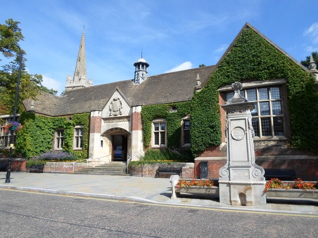
Photo: Burgess Von Thunen, CC BY-SA 2.0.
Kettering Library is a public library in Kettering, England, situated in the centre of the town between Market Place and St Peter and St Paul's Church. Kettering Library is situated 2 miles northwest of The Stirrup Cup.
Kettering railway station
Railway station
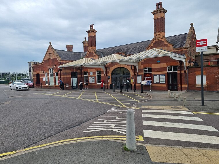
Photo: Bearas, CC BY-SA 4.0.
Kettering railway station serves the market and industrial town of Kettering, in Northamptonshire, England. It lies south-west of the town centre, on the Midland Main Line, 71 miles north of London St. Pancras. Kettering railway station is situated 2 miles northwest of The Stirrup Cup.
Places in the Area
Nearby places include Barton Seagrave and Kettering.
Barton Seagrave
Village
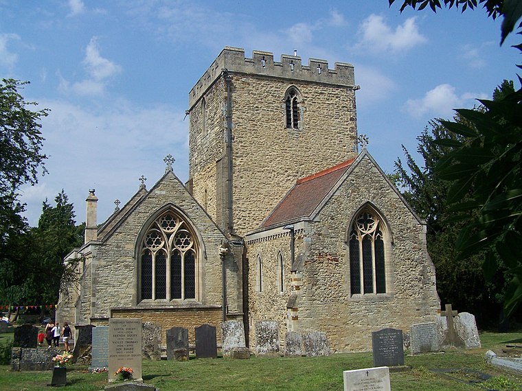
Photo: Geoff Pick, CC BY-SA 2.0.
Barton Seagrave is a large village and civil parish in the North Northamptonshire, England. The village is about 1.5 miles south-east of Kettering, town centre.
Kettering

Photo: Wikimedia, CC BY-SA 2.0.
Kettering is a town of 60,749 people in north Northamptonshire. Kettering owes much of its heritage and growth to the arrival of the railway during the mid-1800s.
Finedon
Town

Photo: Wikimedia, CC BY-SA 2.0.
Finedon is a town and civil parish in North Northamptonshire, England, with a population at the 2021 census of 4,552. In 1086 when the Domesday Book was completed, Finedon was a large royal manor, previously held by Queen Edith, wife of Edward the Confessor. Finedon is situated 3 miles southeast of The Stirrup Cup.
The Stirrup Cup
- Category: building
- Location: Barton Seagrave, Kettering District, North Northamptonshire, England, United Kingdom, Britain and Ireland, Europe
- View on OpenStreetMap
Latitude
52.37837° or 52° 22′ 42″ northLongitude
-0.69087° or 0° 41′ 27″ westOpen location code
9C4X98H5+8MOpenStreetMap ID
way 1273922555OpenStreetMap feature
amenity=pubOpenStreetMap feature
building=yes
This page is based on OpenStreetMap, Wikidata, and Wikimedia Commons.
We’d love your help improving our open data sources. Thank you for contributing.
Satellite Map
Discover The Stirrup Cup from above in high-definition satellite imagery.
Notable Places Nearby
Highlights include Barton Seagrave Primary School and Wallis’s Spinney.
Nearby Places
Explore places such as Barton Seagrave (opp Cottesmore Avenue) and Harry’s News.
England: Must-Visit Destinations
Delve into London, Manchester, Sheffield, and Leeds.
Curious Pubs to Discover
Uncover intriguing pubs from every corner of the globe.
About Mapcarta. Data © OpenStreetMap contributors and available under the Open Database License". Text is available under the CC BY-SA 4.0 license, except for photos, directions, and the map. Photo: sidibousaid, CC BY 2.0.