Luckings Farm
Luckings Farm is a farm in Coleshill, Chiltern District, England. Luckings Farm is situated nearby to the manor estate Hertfordshire House, as well as near the forest Herts Wood.| Tap on a place to explore it |
Places of Interest Nearby
Highlights include Church of All Saints, Coleshill and Hodgemoor Wood.
Church of All Saints, Coleshill
Church

Photo: Sealman, Public domain.
Church of All Saints, Coleshill is situated 2,800 feet north of Luckings Farm.
Hodgemoor Wood
Forest

Photo: Tim Harrison, CC BY-SA 2.0.
Hodgemoor Wood is a biological Site of Special Scientific Interest in Chalfont St Giles in Buckinghamshire. It is in the Chilterns Area of Outstanding Natural Beauty, and most of it is leased by Buckinghamshire County Council to the Forestry Commission.
Bekonscot
Theme park

Photo: MichaelMaggs, CC BY-SA 2.5.
Bekonscot Model Village and Railway is a model village built in the 1920s in Beaconsfield, Buckinghamshire, UK at a scale of one inch to one foot. It portrays aspects of England mostly dating from the 1930s and contains several fictitious villages featuring replicas of notable local buildings. Bekonscot is situated 2 miles south of Luckings Farm.
Places in the Area
Nearby places include Coleshill and Winchmore Hill.
Coleshill
Village
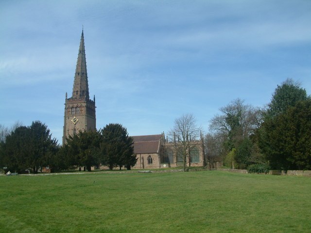
Photo: Mark Walton, CC BY-SA 2.0.
Coleshill is a village and civil parish within Chiltern district in Buckinghamshire, England. It is 2 miles south of Amersham and 3 miles north of Beaconsfield.
Winchmore Hill
Village

Photo: David Hillas, CC BY-SA 2.0.
Winchmore Hill is a village in the parish of Penn, in Buckinghamshire, England. The village has a triangular green in the centre. The houses around the green mainly date from the 20th century.
Knotty Green
Village
Knotty Green was once a rural hamlet in the Buckinghamshire Chiltern Hills. It is characterised by large houses set in their own extensive grounds and though it remains within the civil parish of Penn today it has become contiguous with the market town of Beaconsfield.
Luckings Farm
- Type: Farm
- Category: agriculture
- Location: Coleshill, Chiltern District, Buckinghamshire, South East England, England, United Kingdom, Britain and Ireland, Europe
- View on OpenStreetMap
Latitude
51.6394° or 51° 38′ 22″ northLongitude
-0.63381° or 0° 38′ 2″ westOpen location code
9C3XJ9Q8+QFOpenStreetMap ID
way 1278220006OpenStreetMap feature
landuse=farmyard
This page is based on OpenStreetMap, Wikidata, and Wikimedia Commons.
We’d love your help improving our open data sources. Thank you for contributing.
Satellite Map
Discover Luckings Farm from above in high-definition satellite imagery.
Notable Places Nearby
Highlights include Hertfordshire House and Herts Wood.
Nearby Places
Explore places such as Red Lion and Coleshill Parish Council.
Buckinghamshire: Must-Visit Destinations
Delve into Milton Keynes, Aylesbury, High Wycombe, and Buckingham.
Curious Farms to Discover
Uncover intriguing farms from every corner of the globe.
About Mapcarta. Data © OpenStreetMap contributors and available under the Open Database License". Text is available under the CC BY-SA 4.0 license, except for photos, directions, and the map. Photo: Wikimedia, CC0.