Birchin Grove Farm
Birchin Grove Farm is a farm in Slip End, Central Bedfordshire, England. Birchin Grove Farm is situated nearby to the forest Limekiln Plantation, as well as near Slip End Village School.| Tap on a place to explore it |
Places of Interest Nearby
Highlights include Church of St Andrew, Slip End and Stockwood Park.
Church of St Andrew, Slip End
Church
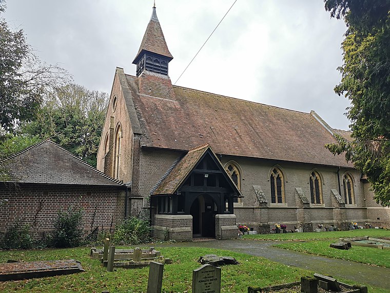
Photo: Alex.brad, CC BY-SA 4.0.
Church of St Andrew, Slip End is situated 3,900 feet north of Birchin Grove Farm.
Stockwood Park
Park

Photo: Richard Thomas, CC BY-SA 2.0.
Stockwood Park is a large urban park in Luton, Bedfordshire, in the Farley Hill estate. With period formal gardens, leading crafts museums, Stockwood Park Rugby Club and extensive golfing facilities, it is about 100 hectares in area. Stockwood Park is situated 1¼ miles north of Birchin Grove Farm.
Caddington Hall
Social service facility

Photo: Wikimedia, Public domain.
Caddington Hall was a country estate in Markyate, Bedfordshire, England. The house was demolished in 1975. In 1804, a family by the name of Pedley traded their farm for the estate, where a small house had stood. They tore it down and built Caddington Hall. Caddington Hall is situated 1 mile west of Birchin Grove Farm.
Places in the Area
Nearby places include Slip End and Woodside.
Slip End
Village

Photo: Nigel Cox, CC BY-SA 2.0.
Slip End is a village and civil parish in Central Bedfordshire, England. The village is very close to Luton. As well as the village of Slip End, the parish contains the hamlets of Lower Woodside, Woodside and Pepperstock.
Woodside
Hamlet

Photo: Nigel Cox, CC BY-SA 2.0.
Woodside is a hamlet located in the Central Bedfordshire district of Bedfordshire, England. Located at the junction of Woodside Road and Grove Road, Woodside stands 546 feet above sea level.
Markyate
Village

Photo: Nigel Cox, CC BY-SA 2.0.
Markyate is a village and civil parish in north-west Hertfordshire, close to the border with Bedfordshire and Buckinghamshire.
Birchin Grove Farm
- Type: Farm
- Category: agriculture
- Location: Slip End, Central Bedfordshire, England, United Kingdom, Britain and Ireland, Europe
- View on OpenStreetMap
Latitude
51.84699° or 51° 50′ 49″ northLongitude
-0.43209° or 0° 25′ 56″ westOpen location code
9C3XRHW9+Q5OpenStreetMap ID
way 1282204471OpenStreetMap feature
landuse=farmyard
This page is based on OpenStreetMap, Wikidata, and Wikimedia Commons.
We’d love your help improving our open data sources. Thank you for contributing.
Satellite Map
Discover Birchin Grove Farm from above in high-definition satellite imagery.
Places with the Same Name
Discover other places named “Birchin Grove Farm”.
Notable Places Nearby
Highlights include Birchin Grove and Limekiln Plantation.
Nearby Places
Explore places such as Fantastic Fireworks and Pepperstock.
England: Must-Visit Destinations
Delve into London, Manchester, Sheffield, and Leeds.
Curious Farms to Discover
Uncover intriguing farms from every corner of the globe.
About Mapcarta. Data © OpenStreetMap contributors and available under the Open Database License". Text is available under the CC BY-SA 4.0 license, except for photos, directions, and the map. Photo: sidibousaid, CC BY 2.0.