Wheatley Rugby Union Football Club
Wheatley Rugby Union Football Club is a sports venue in Wheatley, South Oxfordshire District, England. Wheatley Rugby Union Football Club is situated nearby to the sports venue Park Sports Centre, as well as near the historic site Moated Site of Holton House.| Tap on a place to explore it |
Places of Interest Nearby
Highlights include Shotover Park and Church of St Bartholomew, Holton.
Shotover Park
Manor estate

Photo: Dave Price, CC BY-SA 2.0.
Shotover Park is an 18th-century country house and park near Wheatley, Oxfordshire, England. The house, garden and parkland are Grade I-listed with English Heritage, and 18 additional structures on the property are also listed. Shotover Park is situated 3,500 feet west of Wheatley Rugby Union Football Club.
Church of St Bartholomew, Holton
Church

Photo: Steve Daniels, CC BY-SA 2.0.
Church of St Bartholomew, Holton is situated 3,400 feet east of Wheatley Rugby Union Football Club.
The Sun Inn
Pub
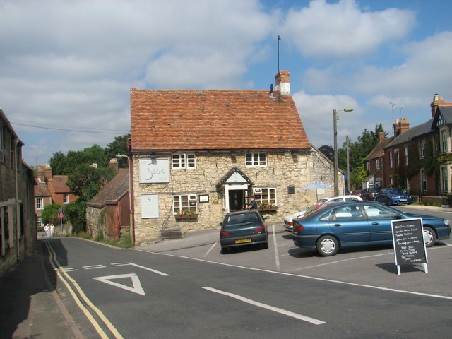
Photo: Roy Parkhouse, CC BY-SA 2.0.
The Sun Inn is a pub, which is situated 2,200 feet south of Wheatley Rugby Union Football Club.
Places in the Area
Nearby places include Holton and Wheatley.
Holton
Hamlet

Photo: Motacilla, CC BY-SA 3.0.
Holton is a village and civil parish in South Oxfordshire about 5.5 miles east of Oxford. The parish is bounded to the southeast by the River Thame, to the east and north by the Thame's tributary Holton Brook, to the south by London Road and to the west by field boundaries with the parishes of Forest Hill with Shotover and Stanton St John.
Wheatley
Village

Photo: Chris Heaton, CC BY-SA 2.0.
Wheatley is a village and civil parish in South Oxfordshire, England, about 5 miles east of Oxford. The parish includes the hamlet of Littleworth, which is west of Wheatley.
Littleworth
Hamlet

Photo: Wikimedia, CC BY-SA 2.0.
Littleworth is a hamlet in South Oxfordshire, about 4+1⁄2 miles east of Oxford, England. It is in Wheatley civil parish, immediately west of Wheatley village.
Wheatley Rugby Union Football Club
- Type: Sports venue
- Address: Holton, Oxford, OX33 1QL
- Categories: rugby, recreation area, and sports location
- Location: Wheatley, South Oxfordshire District, Oxfordshire, South East England, England, United Kingdom, Britain and Ireland, Europe
- View on OpenStreetMap
Latitude
51.75471° or 51° 45′ 17″ northLongitude
-1.13959° or 1° 8′ 23″ westOpen location code
9C3WQV36+V5OpenStreetMap ID
way 1291513275OpenStreetMap feature
leisure=sports_centreOpenStreetMap feature
sport=rugby_union
This page is based on OpenStreetMap, Wikidata, and Wikimedia Commons.
We’d love your help improving our open data sources. Thank you for contributing.
Satellite Map
Discover Wheatley Rugby Union Football Club from above in high-definition satellite imagery.
Notable Places Nearby
Highlights include Park Sports Centre and Moated Site of Holton House.
Nearby Places
Explore places such as Wheatley Rugby Union Football Club and Oxfordshire County Council Library HQ.
Oxfordshire: Must-Visit Destinations
Delve into Oxford, Abingdon-on-Thames, Banbury, and Woodstock.
Curious Sports Venues to Discover
Uncover intriguing sports venues from every corner of the globe.
About Mapcarta. Data © OpenStreetMap contributors and available under the Open Database License". Text is available under the CC BY-SA 4.0 license, except for photos, directions, and the map. Photo: Wikimedia, CC0.