Woodyates Shaw
Woodyates Shaw is a forest in Lewisham, Greater London, England. Woodyates Shaw is situated nearby to the suburb Horn Park, as well as near the neighborhood Burnt Ash Green.| Tap on a place to explore it |
Places of Interest
Highlights include Royal Observatory and Eltham Palace.
Royal Observatory
Museum

Photo: Wikimedia, CC BY-SA 3.0.
The Royal Observatory, Greenwich is an observatory situated on a hill in Greenwich Park in south east London, overlooking the River Thames to the north.
Eltham Palace
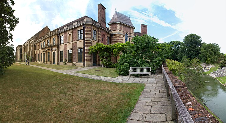
Photo: Tom Parnell, CC BY-SA 2.0.
Eltham Palace is a large house at Eltham in southeast London, England, within the Royal Borough of Greenwich. The house consists of the medieval great hall of a former royal residence, to which an Art Deco extension was added in the 1930s.
Greenwich Park
Park
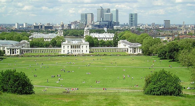
Photo: Sebjarod, Public domain.
Greenwich Park is a former hunting park in Greenwich and one of the largest single green spaces in south-east London. One of the eight Royal Parks of London, and the first to be enclosed, it covers 74 hectares, and is part of the Greenwich World Heritage Site.
Places in the Area
Nearby places include Greenwich and Greenwich.
Greenwich
Photo: Sebjarod, Public domain.
Greenwich is a famous maritime district of south east London - 5.5 miles from central London. An area of great historical importance, the town centre contains Maritime Greenwich - one of London's four UNESCO World Heritage sites - known for its naval history, connections with the Royal Family and as the location from which the Prime Meridian is derived.
Greenwich
Town

Photo: KTC, CC BY-SA 4.0.
Greenwich is an area in south-east London, England, within the ceremonial county of Greater London, 5.5 miles east-south-east of Charing Cross. Greenwich is notable for its maritime history and for giving its name to the Greenwich Meridian and Greenwich Mean Time.
Lewisham
Town

Photo: Likelife, CC BY-SA 3.0.
Lewisham is an area of southeast London, England, six miles south of Charing Cross. It is the principal area of the London Borough of Lewisham, and was within the historic county of Kent until 1889.
Woodyates Shaw
- Type: Forest
- Location: Lewisham, Greater London, England, United Kingdom, Britain and Ireland, Europe
- View on OpenStreetMap
Latitude
51.4484° or 51° 26′ 54″ northLongitude
0.0199° or 0° 1′ 12″ eastOpen location code
9F32C2X9+9XOpenStreetMap ID
way 1296166593OpenStreetMap feature
natural=wood
This page is based on OpenStreetMap, Wikidata, and Wikimedia Commons.
We’d love your help improving our open data sources. Thank you for contributing.
Satellite Map
Discover Woodyates Shaw from above in high-definition satellite imagery.
Localities in the Area
Explore places such as Horn Park and Burnt Ash Green.
Notable Places Nearby
Highlights include Colfe’s Leisure Centre and Colfe’s School.
England: Must-Visit Destinations
Delve into London, Manchester, Sheffield, and Leeds.
Curious Forests to Discover
Uncover intriguing forests from every corner of the globe.
About Mapcarta. Data © OpenStreetMap contributors and available under the Open Database License". Text is available under the CC BY-SA 4.0 license, except for photos, directions, and the map. Photo: sidibousaid, CC BY 2.0.