Parque Empresarial Oviedo (Fase II)
Parque Empresarial Oviedo (Fase II) is in Oviedo, Asturias. Parque Empresarial Oviedo (Fase II) is situated nearby to the pitch El Llerón, as well as near the manor estate Quinta Landeta.| Tap on a place to explore it |
Places of Interest Nearby
Highlights include Church of Santa María de Bendones and Tudela-Veguín train station.
Church of Santa María de Bendones
Church

Photo: Wikimedia, CC BY-SA 2.5.
St. Mary of Bendones is an Asturian Pre-Romanesque Roman Catholic church situated in Bendones, Spain, build between 792 and 842. It was designated a Spanish National Monument in 1958. Church of Santa María de Bendones is situated 1½ km northwest of Parque Empresarial Oviedo (Fase II).
Tudela-Veguín train station
Railway stop

Photo: Jose Luis Martinez - jlmaral, CC BY-SA 2.0.
Tudela-Veguín train station is a railway stop, which is situated 1½ km northeast of Parque Empresarial Oviedo (Fase II).
Santa Eulalia de Manzaneda train station
Railway stop

Photo: BochiBochiGalaxy, CC BY-SA 4.0.
Santa Eulalia de Manzaneda train station is a railway stop, which is situated 1½ km southwest of Parque Empresarial Oviedo (Fase II).
Places in the Area
Nearby places include Tudela Agüeria and Naves.


Bendones
Hamlet
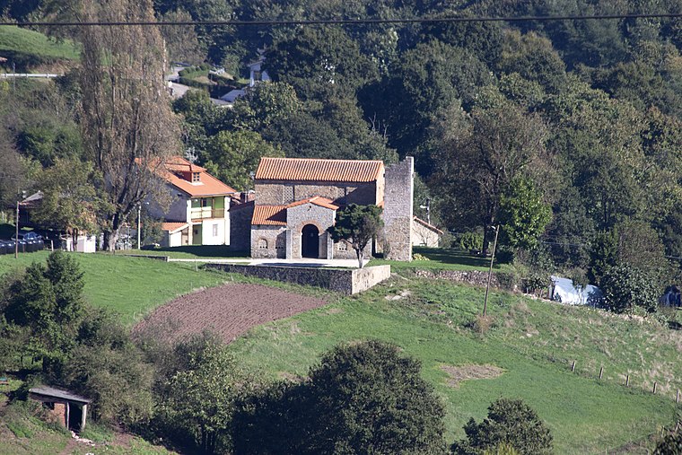
Photo: Carmenmoran, CC BY 4.0.
Bendones is a parroquia of the municipality of Oviedo in the autonomous community of Asturias, Spain. Bendones contains a church, Santa María de Bendones, which dates to the time of Alfonso II. It was declared a national monument in 1958.
Parque Empresarial Oviedo (Fase II)
- Type: Industry
- Location: Oviedo, Asturias, Green Spain, Spain, Iberia, Europe
- View on OpenStreetMap
Latitude
43.32395° or 43° 19′ 26″ northLongitude
-5.79438° or 5° 47′ 40″ westOpen location code
8CMP86F4+H6OpenStreetMap ID
way 1297687864OpenStreetMap feature
landuse=industrial
This page is based on OpenStreetMap, Wikidata, and Wikimedia Commons.
We’d love your help improving our open data sources. Thank you for contributing.
Satellite Map
Discover Parque Empresarial Oviedo (Fase II) from above in high-definition satellite imagery.
Notable Places Nearby
Highlights include El Llerón and Quinta Landeta.
Nearby Places
Explore places such as GRUAS SERTIBER and Anieves.
Asturias: Must-Visit Destinations
Delve into Gijón, Villaviciosa, Grado, and Salas.
Curious Places to Discover
Uncover intriguing places from every corner of the globe.
About Mapcarta. Data © OpenStreetMap contributors and available under the Open Database License". Text is available under the CC BY-SA 4.0 license, except for photos, directions, and the map. Photo: Wikimedia, CC0.