P5
P5 is a parking area in Lajes, Praia da Vitória. P5 is situated nearby to the police station Esquadra da Polícia de Segurança Pública, Aeroporto das Lajes, as well as near the motorhome stopover P6.| Tap on a place to explore it |
Places of Interest Nearby
Highlights include Lajes Airport and Church of São Miguel Arcanjo.
Lajes Airport
Airport terminal

Photo: Wikimedia, CC BY-SA 4.0.
Lajes Airport is located in the parish and Vila das Lajes, in the municipality of Praia da Vitória, on Terceira Island, in the Azores. Lajes Airport is situated 160 metres northwest of P5.
Church of São Miguel Arcanjo
Church
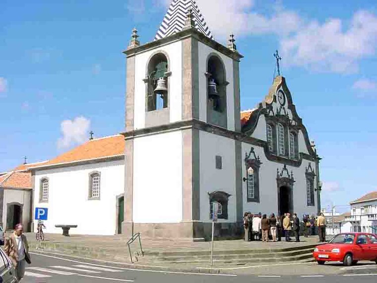
Photo: Luissilveira, Public domain.
Church of São Miguel Arcanjo is situated 2 km northwest of P5.
Edifício dos Paços do Concelho da Praia da Vitória, Praia da Vitória
Public building

Photo: Concierge.2C, CC BY-SA 3.0.
Edifício dos Paços do Concelho da Praia da Vitória, Praia da Vitória is a public building, which is situated 3½ km southeast of P5.
P5
- Type: Parking area
- Parking: surface
- Category: transportation
- Location: Lajes, Praia da Vitória, Terceira, Azores, Portugal, Iberia, Europe
- View on OpenStreetMap
Latitude
38.75299° or 38° 45′ 11″ northLongitude
-27.08616° or 27° 5′ 10″ westOpen location code
89CJQW37+5GOpenStreetMap ID
way 1301181372OpenStreetMap feature
amenity=parkingOpenStreetMap attribute
parking=surface
This page is based on OpenStreetMap, Wikidata, and Wikimedia Commons.
We’d love your help improving our open data sources. Thank you for contributing.
Satellite Map
Discover P5 from above in high-definition satellite imagery.
Notable Places Nearby
Highlights include Esquadra da Polícia de Segurança Pública, Aeroporto das Lajes and P6.
Nearby Places
Explore places such as P7 and P4.
Azores: Must-Visit Destinations
Delve into Ponta Delgada, Angra do Heroísmo, Pico, and Faial.
Curious Parking Areas to Discover
Uncover intriguing parking areas from every corner of the globe.
About Mapcarta. Data © OpenStreetMap contributors and available under the Open Database License". Text is available under the CC BY-SA 4.0 license, except for photos, directions, and the map. Photo: Ymblanter, CC BY-SA 4.0.