Great Pond II Trust Land
Great Pond II Trust Land is a nature reserve in Town of Cape Elizabeth, Cumberland County, Maine. Great Pond II Trust Land is situated nearby to the neighborhood Elizabeth Park, as well as near Pond Cove.| Tap on a place to explore it |
Places of Interest
Highlights include Two Lights and Spurwink Church.
Two Lights
Lighthouse

Photo: Wikimedia, CC BY-SA 3.0.
Cape Elizabeth Light is a lighthouse in Cape Elizabeth, at the southwestern entrance to Casco Bay in Maine. Only the eastern tower of the two that made up the light station until 1924 is active.
Spurwink Church
Church
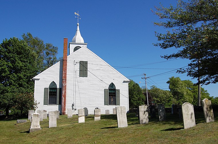
Photo: Rich Brooks, CC BY 2.0.
Spurwink Congregational Church is a historic church at 533 Spurwink Avenue in Cape Elizabeth, Maine. Built in 1802 and significantly renovated in 1830, it is the town's oldest public building.
Cape Elizabeth High School
School
Cape Elizabeth High School is a public high school in Cape Elizabeth, Maine, United States. It is one of six schools in Maine to have been named a National Blue Ribbon School multiple times by the U.S. Department of Education.
Places in the Area
Nearby places include Cape Elizabeth.
Cape Elizabeth

Photo: Southgeist, CC BY 3.0.
Cape Elizabeth is an upscale community about 5 miles southeast of Portland, Maine on the Southern Maine coast. Its centerpiece is the 90 acre Fort Williams bought by the town in 1964.
Great Pond II Trust Land
- Type: Nature reserve
- Category: recreation area
- Location: Town of Cape Elizabeth, Cumberland County, Lakes and Mountains, Maine, New England, United States, North America
- View on OpenStreetMap
Latitude
43.5797° or 43° 34′ 47″ northLongitude
-70.2273° or 70° 13′ 38″ westOpen location code
87MFHQHF+V3OpenStreetMap ID
way 1301208710OpenStreetMap feature
leisure=nature_reserve
This page is based on OpenStreetMap, Wikidata, and Wikimedia Commons.
We’d love your help improving our open data sources. Thank you for contributing.
Satellite Map
Discover Great Pond II Trust Land from above in high-definition satellite imagery.
Localities in the Area
Explore places such as Elizabeth Park and Pond Cove.
Notable Places Nearby
Highlights include Sea Side Cemetery and Cape Elizabeth Church.
Cumberland County: Must-Visit Destinations
Delve into Standish, Bridgton, New Gloucester, and Frye Island.
Curious Nature Reserves to Discover
Uncover intriguing nature reserves from every corner of the globe.
About Mapcarta. Data © OpenStreetMap contributors and available under the Open Database License". Text is available under the CC BY-SA 4.0 license, except for photos, directions, and the map. Photo: Wikimedia, CC0.