York Bus SW
York Bus SW is an industrial building in York, England. York Bus SW is situated nearby to the social club SL27, as well as near The Waggon And Horses Public House (Number 19).| Tap on a place to explore it |
Places of Interest Nearby
Highlights include Red Tower and York Minster.
Red Tower
Community center

Photo: HJ Mitchell, CC BY 3.0.
The Red Tower is a medieval tower that formed part of the city defences of York, England. It is located on the city walls at Foss Islands Road, on the stretch of wall north of Walmgate Bar and is the only brick tower in the city. Red Tower is situated 890 feet northwest of York Bus SW.
York Minster
Church
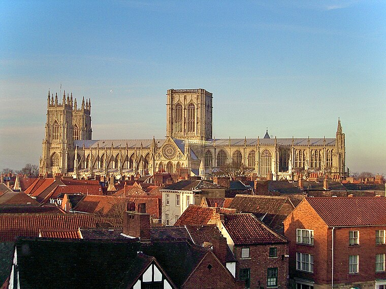
Photo: MatzeTrier, CC BY-SA 3.0.
York Minster, formally the Cathedral and Metropolitical Church of Saint Peter in York, is an Anglican cathedral in the city of York, North Yorkshire, England. York Minster is situated 3,700 feet northwest of York Bus SW.
St Lawrence’s Church, York
Church

Photo: Wikimedia, Public domain.
St Lawrence Parish Church is an active Anglican church in York, England. It is situated in Lawrence Street, just outside Walmgate Bar. St Lawrence’s Church, York is situated 1,000 feet south of York Bus SW.
Places in the Area
Nearby places include Layerthorpe and Fishergate.
Layerthorpe
Suburb
Layerthorpe is a part of the city of York in, North Yorkshire, England. It is outside the city walls of York. The road through Layerthorpe from the bridge over the River Foss to Heworth is also shares the same name.
York

Photo: robbophotos, CC BY 2.0.
The ancient cathedral city of York has a history dating back over 2000 years. Romans, Saxons, Vikings, and Britons from all eras have each left their mark.
York Bus SW
- Type: Industrial building
- Categories: building and industry
- Location: York, England, United Kingdom, Britain and Ireland, Europe
- View on OpenStreetMap
Latitude
53.95653° or 53° 57′ 24″ northLongitude
-1.06802° or 1° 4′ 5″ westOperator
Northern PowergridOpen location code
9C5WXW4J+JQOpenStreetMap ID
way 1301737046OpenStreetMap feature
building=industrial
This page is based on OpenStreetMap, Wikidata, and Wikimedia Commons.
We’d love your help improving our open data sources. Thank you for contributing.
Satellite Map
Discover York Bus SW from above in high-definition satellite imagery.
Notable Places Nearby
Highlights include SL27 and The Waggon And Horses Public House (Number 19).
Nearby Places
Explore places such as RET York and Elvington Floorcraft Ltd..
England: Must-Visit Destinations
Delve into London, Manchester, Sheffield, and Leeds.
Curious Industrial Buildings to Discover
Uncover intriguing industrial buildings from every corner of the globe.
About Mapcarta. Data © OpenStreetMap contributors and available under the Open Database License". Text is available under the CC BY-SA 4.0 license, except for photos, directions, and the map. Photo: sidibousaid, CC BY 2.0.