Lillebytunet
Lillebytunet is in Trondheim, Trøndelag. Lillebytunet is situated nearby to Maskinparken, as well as near the cemetery Lademoen kirkegård.| Tap on a place to explore it |
Places of Interest Nearby
Highlights include Lademoen kirkegård and Lade Church.
Lademoen kirkegård
Cemetery

Photo: Vinguru, CC BY-SA 4.0.
Lademoen kirkegård is a cemetery, which is situated 270 metres southwest of Lillebytunet.
Lade Church
Church

Photo: Pbm, CC BY-SA 3.0.
Lade Church is one of Norway's oldest existing stone churches. It is a parish church of the Church of Norway in Trondheim Municipality in Trøndelag county, Norway. Lade Church is situated 570 metres north of Lillebytunet.
Ringve Museum
Museum
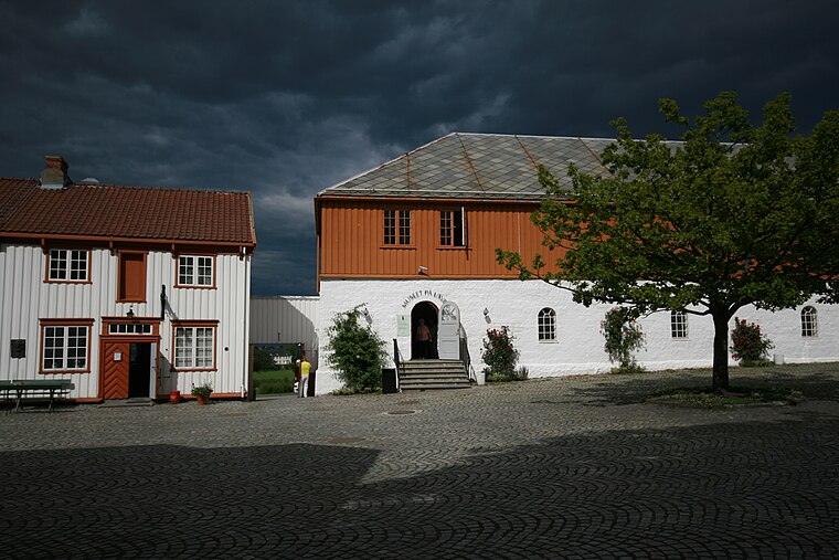
Photo: Ringve, CC BY-SA 3.0.
Ringve Museum is Norway's national museum for music and musical instruments, with collections from all over the world. Ringve Museum is situated 1 km northeast of Lillebytunet.
Places in the Area
Nearby places include Lade and Lademoen.
Lade
Suburb
Photo: Orcaborealis, CC BY-SA 2.5.
Lade is a neighborhood in the city of Trondheim in Trøndelag county, Norway. It is in the borough of Østbyen in Trondheim Municipality, just northeast of the city centre of Midtbyen and north of the Lademoen neighborhood.
Lademoen
Suburb
Lademoen is a neighborhood in the city of Trondheim in Trøndelag county, Norway. It is situated the borough of Østbyen in Trondheim Municipality, about 2 kilometres east of Midtbyen, the city centre of Trondheim.
Leangen
Quarter
Leangen is a largely industrial neighborhood in the city of Trondheim in Trøndelag county, Norway. It is located in the borough of Østbyen in Trondheim Municipality.
Lillebytunet
- Type: Construction
- Location: Trondheim, Trøndelag, Norway, Nordic countries, Europe
- View on OpenStreetMap
Latitude
63.44121° or 63° 26′ 28″ northLongitude
10.44048° or 10° 26′ 26″ eastOperator
NordrOpen location code
9FMGCCRR+F5OpenStreetMap ID
way 1308461524OpenStreetMap feature
landuse=construction
This page is based on OpenStreetMap, Wikidata, and Wikimedia Commons.
We’d love your help improving our open data sources. Thank you for contributing.
Satellite Map
Discover Lillebytunet from above in high-definition satellite imagery.
Notable Places Nearby
Highlights include Maskinparken and Tren Her.
Nearby Places
Explore places such as Ståltaugen 1 and Ståltaugen 2.
Trøndelag: Must-Visit Destinations
Delve into Røros, Namsos, Oppdal, and Stjørdalshalsen.
Curious Places to Discover
Uncover intriguing places from every corner of the globe.
About Mapcarta. Data © OpenStreetMap contributors and available under the Open Database License". Text is available under the CC BY-SA 4.0 license, except for photos, directions, and the map. Photo: Wikimedia, CC0.