Pôle Multimodal
Pôle Multimodal is a bus station in Vesoul, Haute-Saône, Bourgogne-Franche-Comté. Pôle Multimodal is situated nearby to the railway station Vesoul station, as well as near the playground Aire de jeux du 11e Chasseurs.| Tap on a place to explore it |
- Type: Bus station
- Also known as: “PEM”
- Wheelchair access: yes
Places of Interest Nearby
Highlights include Vesoul station and Église du Sacré-Cœur de Vesoul.
Vesoul station
Railway station
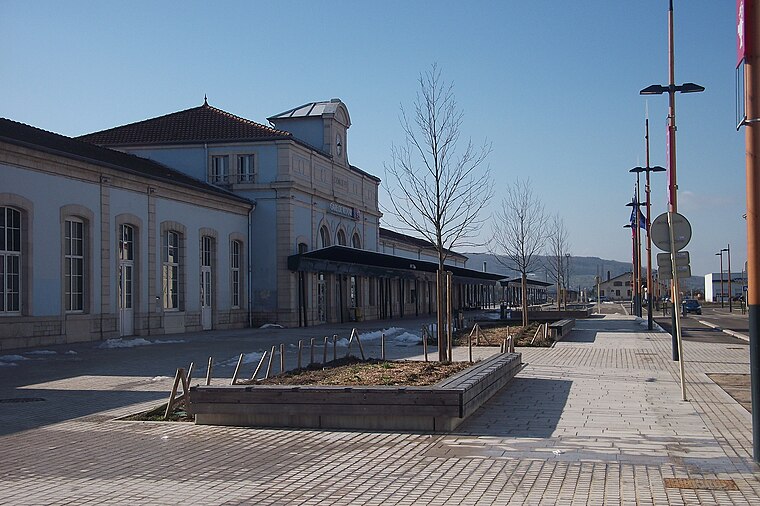
Photo: Nerio9, CC BY-SA 3.0.
Vesoul station is the railway station serving the commune of Vesoul, in the Haute-Saône department of eastern France. Vesoul station is situated 120 metres southeast of Pôle Multimodal.
Église du Sacré-Cœur de Vesoul
Church

Photo: Nério9, CC BY-SA 3.0.
Église du Sacré-Cœur de Vesoul is a church, which is situated 500 metres southeast of Pôle Multimodal.
Edwige Feuillère Theatre
Theater building

Photo: Sdfghfk, CC BY-SA 4.0.
Edwige Feuillère Theatre is a theater building, which is situated 760 metres east of Pôle Multimodal.
Places in the Area
Nearby places include Navenne and Échenoz-la-Méline.
Navenne
Village
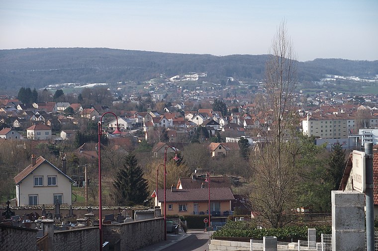
Photo: Nerio9, CC BY-SA 3.0.
Navenne is a commune in the Haute-Saône department in the region of Bourgogne-Franche-Comté in eastern France. The town is located near Vesoul.
Échenoz-la-Méline
Village

Photo: Sergevieille, CC BY-SA 4.0.
Échenoz-la-Méline is a commune in the Haute-Saône department in the region of Bourgogne-Franche-Comté in eastern France. The town is located near Vesoul.
Frotey-lès-Vesoul
Village

Photo: Nerio9, CC BY-SA 3.0.
Frotey-lès-Vesoul is a commune in the Haute-Saône department in the region of Bourgogne-Franche-Comté in eastern France. The town is located near Vesoul. Frotey-lès-Vesoul is situated 2½ km east of Pôle Multimodal.
Pôle Multimodal
- Categories: station and transportation
- Location: Vesoul, Arrondissement of Vesoul, Haute-Saône, Franche-Comté, Bourgogne-Franche-Comté, France, Europe
- View on OpenStreetMap
Latitude
47.6182° or 47° 37′ 6″ northLongitude
6.15055° or 6° 9′ 2″ eastOpen location code
8FV8J592+76OpenStreetMap ID
way 1310659057OpenStreetMap feature
amenity=bus_stationOpenStreetMap feature
public_transport=stationOpenStreetMap attribute
wheelchair=yes
This page is based on OpenStreetMap, Wikidata, and Wikimedia Commons.
We’d love your help improving our open data sources. Thank you for contributing.
Satellite Map
Discover Pôle Multimodal from above in high-definition satellite imagery.
Notable Places Nearby
Highlights include Aire de jeux du 11e Chasseurs and Chambre d’agriculture Haute-Saône.
Nearby Places
Explore places such as Pôle Multimodal and Mon Coiffeur.
Franche-Comté: Must-Visit Destinations
Delve into Besançon, Dole, Saint-Claude, and Nans-sous-Sainte-Anne.
Curious Bus Stations to Discover
Uncover intriguing bus stations from every corner of the globe.
About Mapcarta. Data © OpenStreetMap contributors and available under the Open Database License". Text is available under the CC BY-SA 4.0 license, except for photos, directions, and the map. Photo: Remi Mathis, CC BY-SA 3.0.