Chelmsley Wood Car Boot Market (Tuesday/Friday)
Chelmsley Wood Car Boot Market (Tuesday/Friday) is a marketplace in Coleshill, North Warwickshire District, England. Chelmsley Wood Car Boot Market (Tuesday/Friday) is situated nearby to Woodlands Cemetery and Crematorium, as well as near Cole Bank Park Local Nature Reserve.| Tap on a place to explore it |
Places of Interest Nearby
Highlights include Church of St Peter and St Paul, Coleshill and John Henry Newman Catholic College.
Church of St Peter and St Paul, Coleshill
Church
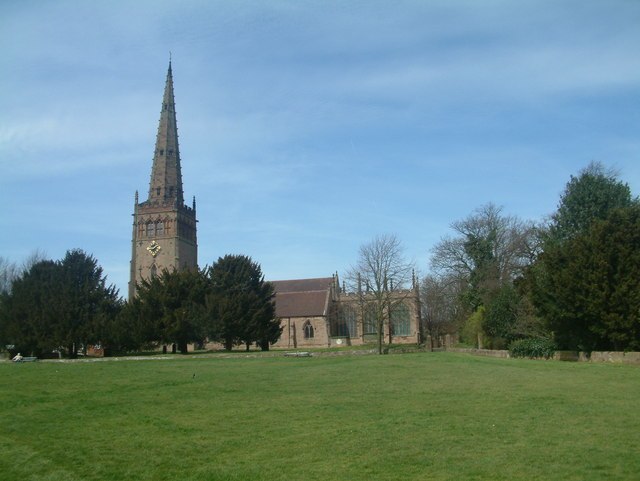
Photo: Mark Walton, CC BY-SA 2.0.
The Church of St. Peter and St. Paul, often referred to as Coleshill Parish Church, is the Anglican parish church of Coleshill, Warwickshire, England. It has been a Grade I listed building since 1961, and was built between the 14th and 15th centuries, with the current spire built in the 1860s. Church of St Peter and St Paul, Coleshill is situated 1¼ miles northeast of Chelmsley Wood Car Boot Market (Tuesday/Friday).
John Henry Newman Catholic College
School
John Henry Newman Catholic College, formerly Archbishop Grimshaw School, is an English Catholic School located in Fordbridge, North Solihull. John Henry Newman Catholic College is situated 1 mile southwest of Chelmsley Wood Car Boot Market (Tuesday/Friday).
The Coleshill School
School
The Coleshill School is a school with academy status in Coleshill, Warwickshire, England, founded in 1520. The Coleshill School is situated 1¼ miles southeast of Chelmsley Wood Car Boot Market (Tuesday/Friday).
Places in the Area
Nearby places include Fordbridge and Chelmsley Wood.
Fordbridge
Suburb
Fordbridge is a town and civil parish in the Metropolitan Borough of Solihull, in the West Midlands, England. According to the 2001 census, the parish had a population of 8,749.
Chelmsley Wood
Town

Photo: Carl Baker, CC BY-SA 2.0.
Chelmsley Wood, sometimes called just Chelmsley, is a town and civil parish in the Metropolitan Borough of Solihull, West Midlands, England, with a population of 12,453.
Kingshurst
Village
Kingshurst is a large post-war suburban village and civil parish in the Metropolitan Borough of Solihull, in the West Midlands, England. Historically part of the county of Warwickshire in the Meriden Rural District, It lies about 7 miles north of Solihull town centre, 10 miles east of Birmingham and 13 miles northwest of Coventry, it borders North Warwickshire to the east.
Chelmsley Wood Car Boot Market (Tuesday/Friday)
Latitude
52.49075° or 52° 29′ 27″ northLongitude
-1.72981° or 1° 43′ 47″ westOperator
ebootOpen location code
9C4WF7RC+83OpenStreetMap ID
way 1312643772OpenStreetMap feature
amenity=marketplace
This page is based on OpenStreetMap, Wikidata, and Wikimedia Commons.
We’d love your help improving our open data sources. Thank you for contributing.
Satellite Map
Discover Chelmsley Wood Car Boot Market (Tuesday/Friday) from above in high-definition satellite imagery.
Notable Places Nearby
Highlights include Woodlands Cemetery and Crematorium and Cole Bank Park Local Nature Reserve.
Nearby Places
Explore places such as Chelmsley Wood Royal British Legion Club and Birmingham Rd / Chester Rd.
Warwickshire: Must-Visit Destinations
Delve into Stratford-upon-Avon, Warwick, Rugby, and Leamington Spa.
Curious Marketplaces to Discover
Uncover intriguing marketplaces from every corner of the globe.
About Mapcarta. Data © OpenStreetMap contributors and available under the Open Database License". Text is available under the CC BY-SA 4.0 license, except for photos, directions, and the map. Photo: brianac37, CC BY 2.0.