Church Ledge
Church Ledge is a reef in St. Mary’s, Isles of Scilly, England. Church Ledge is situated nearby to the locality Giant’s Castle, as well as near the peak Ward Hill.| Tap on a place to explore it |
Places of Interest Nearby
Highlights include St Mary’s Airport and Porth Hellick Down.
St Mary’s Airport
Aerodrome

Photo: Wikimedia, CC BY-SA 3.0.
St Mary's Airport or Isles of Scilly Airport is an airport located 1 nautical mile east of Hugh Town on St Mary's in the Isles of Scilly, to the south west of Cornwall, UK.
Porth Hellick Down
Heath
Porth Hellick Down is a Neolithic and Bronze Age archeological site located on the island of St Mary's, in the Isles of Scilly in Great Britain. The ancient burial monument encompasses a large cairn cemetery that includes at least six entrance graves, other unchambered cairns, and a prehistoric field system. Porth Hellick Down is situated 3,500 feet northeast of Church Ledge.
Saint Mary’s Light
Lighthouse

Photo: Caroline Tandy, CC BY-SA 2.0.
Peninnis Lighthouse is situated on Peninnis Head, St Mary's, Isles of Scilly. Saint Mary’s Light is situated 4,100 feet southwest of Church Ledge.
Places in the Area
Nearby places include Giant’s Castle and Old Town.
Giant’s Castle
Locality

Photo: PaulaSL, CC BY-SA 4.0.
The Giant's Castle is a promontory fort of the Iron Age, on St Mary's, Isles of Scilly, England. It is a scheduled monument.
Old Town
Village

Photo: Matteosoldati, CC BY-SA 3.0.
Old Town is a village on St Mary's in the Isles of Scilly located southeast of Hugh Town. It is thought to be the oldest settlement on the island. It is a popular tourist area and is only a short distance from the island's airport.
Peninnis Head
Locality
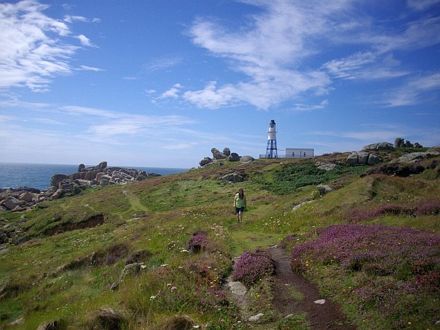
Photo: Bob Embleton, CC BY-SA 2.0.
Peninnis Head is the southernmost point of St Mary's, Isles of Scilly. The headland is within the Isles of Scilly Area of Outstanding Natural Beauty and part of the Heritage Coast.
Church Ledge
- Type: Reef
- Category: landform
- Location: St. Mary’s, Isles of Scilly, West Country, England, United Kingdom, Britain and Ireland, Europe
- View on OpenStreetMap
Latitude
49.90918° or 49° 54′ 33″ northLongitude
-6.28766° or 6° 17′ 16″ westOpen location code
8CXMWP56+MWOpenStreetMap ID
way 1313731916OpenStreetMap feature
natural=reef
This page is based on OpenStreetMap, Wikidata, and Wikimedia Commons.
We’d love your help improving our open data sources. Thank you for contributing.
Satellite Map
Discover Church Ledge from above in high-definition satellite imagery.
Places with the Same Name
Discover other places named “Church Ledge”.
Notable Places Nearby
Highlights include Ward Hill and Mainmark Rock.
Nearby Places
Explore places such as Blue Carn and Inner Blue Carn.
West Country: Must-Visit Destinations
Delve into Bristol, Stonehenge, Bath, and Plymouth.
Curious Reefs to Discover
Uncover intriguing reefs from every corner of the globe.
About Mapcarta. Data © OpenStreetMap contributors and available under the Open Database License". Text is available under the CC BY-SA 4.0 license, except for photos, directions, and the map. Photo: AlasdairW, CC BY-SA 3.0.