Bay Area Transportation Authority
Bay Area Transportation Authority is a building in Charter Township of Garfield, Grand Traverse, Michigan. Bay Area Transportation Authority is situated nearby to the bus station LaFranier Transfer Station, as well as near Prince of Peace Evangelical Lutheran Church.| Tap on a place to explore it |
Places of Interest Nearby
Highlights include Cherry Capital Airport and Grand Traverse Mall.
Cherry Capital Airport
Aerodrome

Photo: My name, CC BY-SA 3.0.
Cherry Capital Airport is a commercial and general aviation airport located in Traverse City, Michigan, United States. The airport is located two nautical miles southeast of the central business district of Traverse City. Cherry Capital Airport is situated 2 miles northeast of Bay Area Transportation Authority.
Grand Traverse Mall
Shopping center

Photo: TenPoundHammer, CC BY-SA 4.0.
Grand Traverse Mall is an enclosed shopping mall serving Traverse City, Michigan, located in Garfield Township. Opened in 1992, the mall features three anchor stores: JCPenney, Target, and Dunham's Sports. Grand Traverse Mall is situated 2 miles west of Bay Area Transportation Authority.
Coast Guard Air Station Traverse City
Military installation
Coast Guard Air Station Traverse City is an Air Station of the United States Coast Guard located in Traverse City, Michigan. The station was established in 1946 and operates under the authority of the Coast Guard's Ninth District. Coast Guard Air Station Traverse City is situated 2½ miles northeast of Bay Area Transportation Authority.
Places in the Area
Nearby places include Central Neighborhood Historic District and Traverse City.
Central Neighborhood Historic District
Quarter
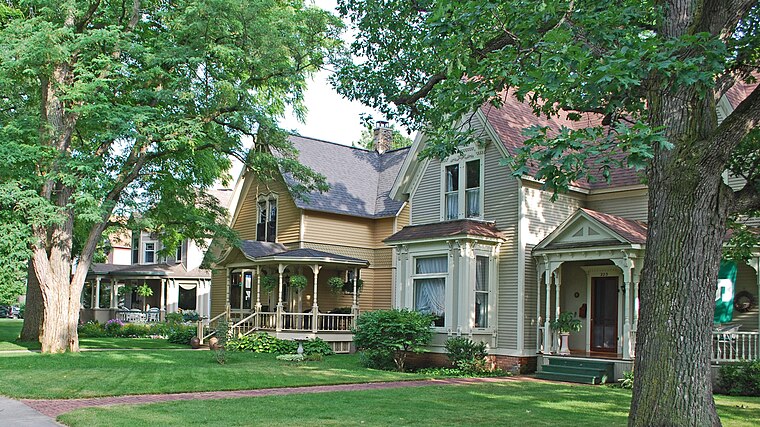
Photo: Andrew Jameson, CC BY-SA 3.0.
The Central Neighborhood Historic District is a residential historic district, roughly bounded by 5th, Union, 9th, and Division Streets in Traverse City, Michigan. Central Neighborhood Historic District is situated 3 miles northwest of Bay Area Transportation Authority.
Traverse City

Photo: Andrew Jameson, CC BY-SA 3.0.
Traverse City is a scenic city on the Grand Traverse Bay of Lake Michigan. Directly north of Traverse City, the Old Mission Peninsula splits the Grand Traverse Bay in two, with a beautiful windswept landscape and great views of the bay on either side.
Boardman Neighborhood Historic District
Quarter

Photo: Andrew Jameson, CC BY-SA 3.0.
The Boardman Neighborhood Historic District is a residential historic district in Traverse City, Michigan, United States, roughly bounded by State Street, Webster Street, Railroad Avenue, and Boardman Avenue. Boardman Neighborhood Historic District is situated 3 miles north of Bay Area Transportation Authority.
Bay Area Transportation Authority
Latitude
44.71608° or 44° 42′ 58″ northLongitude
-85.60389° or 85° 36′ 14″ westNetwork
BATAOpen location code
86PPP98W+CCOpenStreetMap ID
way 1313805217OpenStreetMap feature
building=yes
This page is based on OpenStreetMap, Wikidata, and Wikimedia Commons.
We’d love your help improving our open data sources. Thank you for contributing.
Satellite Map
Discover Bay Area Transportation Authority from above in high-definition satellite imagery.
Notable Places Nearby
Highlights include LaFranier Transfer Station and Prince of Peace Evangelical Lutheran Church.
Nearby Places
Explore places such as Hammond Commerce Centre and Ridge 45 Building 2545.
Michigan: Must-Visit Destinations
Delve into Detroit, Ann Arbor, Lansing, and Grand Rapids.
Curious Buildings to Discover
Uncover intriguing buildings from every corner of the globe.
About Mapcarta. Data © OpenStreetMap contributors and available under the Open Database License". Text is available under the CC BY-SA 4.0 license, except for photos, directions, and the map. Photo: Wikimedia, CC0.