Whitefriars Gate
Whitefriars Gate is a city gate in King’s Lynn and West Norfolk District, Norfolk, England. Whitefriars Gate is situated nearby to the playground Whitefriars Play Area, as well as near Church of All Saints.| Tap on a place to explore it |
Places of Interest Nearby
Highlights include Church of All Saints and King’s Lynn Minster.
Church of All Saints
Church
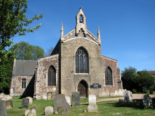
Photo: Evelyn Simak, CC BY-SA 2.0.
Church of All Saints is situated 570 feet east of Whitefriars Gate.
King’s Lynn Minster
Church

Photo: Richard Humphrey, CC BY-SA 2.0.
St Margaret's Church, King's Lynn, entitled King's Lynn Minster since 2011, is a Grade I listed parish church in the Church of England in King's Lynn, Norfolk. King’s Lynn Minster is situated 1,100 feet north of Whitefriars Gate.
King’s Lynn Library
Library

Photo: Tim Heaton, CC BY-SA 2.0.
King’s Lynn Library is situated 990 feet northeast of Whitefriars Gate.
Places in the Area
Nearby places include King’s Lynn and West Lynn.
King’s Lynn

Photo: AlasdairW, CC BY-SA 3.0.
King's Lynn is the third largest town in Norfolk in England with a population of 42,800. It is a town with great history, having being founded in medieval times, and is situated towards the west of the county on the Great Ouse river and near the Wash estuary.
West Lynn
Village

Photo: Martin Pearman, CC BY-SA 2.0.
West Lynn is a suburb of King's Lynn in Norfolk, England, situated on the west bank of the River Great Ouse. It is linked to the main part of the town, on the east bank, either by a passenger ferry or via a more circuitous 4 kilometres road journey.
North Runcton
Village

Photo: Wikimedia, CC BY-SA 2.0.
North Runcton is a village and a civil parish in the English county of Norfolk. The village is 43.2 miles west of Norwich, 4.3 miles south-south-east of King's Lynn and 102 miles north of London. North Runcton is situated 2½ miles southeast of Whitefriars Gate.
Whitefriars Gate
- Type: City gate
- Categories: building, historic site, tourist attraction, and tourism
- Location: King’s Lynn and West Norfolk District, Norfolk, East of England, England, United Kingdom, Britain and Ireland, Europe
- View on OpenStreetMap
Latitude
52.7489° or 52° 44′ 56″ northLongitude
0.39695° or 0° 23′ 49″ eastOpen location code
9F42P9XW+HQOpenStreetMap ID
way 1318084678OpenStreetMap feature
building=yesOpenStreetMap feature
historic=city_gate
This page is based on OpenStreetMap, Wikidata, and Wikimedia Commons.
We’d love your help improving our open data sources. Thank you for contributing.
Satellite Map
Discover Whitefriars Gate from above in high-definition satellite imagery.
Notable Places Nearby
Highlights include Whitefriars Play Area and Whitefriars Church of England Primary Academy.
Nearby Places
Explore places such as Nar Sure Start Children’s Centre and Hillington Square.
Norfolk: Must-Visit Destinations
Delve into Norwich, King’s Lynn, Great Yarmouth, and Norfolk Broads.
Curious City Gates to Discover
Uncover intriguing city gates from every corner of the globe.
About Mapcarta. Data © OpenStreetMap contributors and available under the Open Database License". Text is available under the CC BY-SA 4.0 license, except for photos, directions, and the map. Photo: matthewhartley369, CC BY-SA 2.0.