Community Charter School of Cambridge
Community Charter School of Cambridge is a charter school located in Cambridge, Massachusetts, United States. Located in the Kendall Square area near MIT, the school serves 360 students in grades 6-12. CCSC opened in September 2005.| Tap on a place to explore it |
- Type: School
- Description: high school in Massachusetts, United States
- Address: 245 Bent Street, Cambridge, MA 02141
Places of Interest Nearby
Highlights include TD Garden and Massachusetts General Hospital.
TD Garden
Stadium
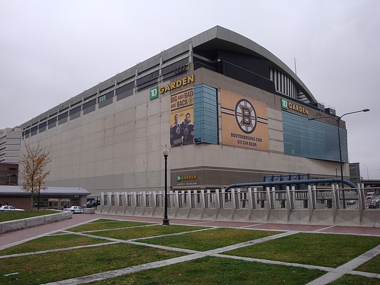
Photo: Nywalton, Public domain.
TD Garden is a multi-purpose arena in Boston. It is located directly above the MBTA's North Station, and it replaced the original Boston Garden upon opening in 1995. TD Garden is situated 1¼ miles east of Community Charter School of Cambridge.
Massachusetts General Hospital
Hospital

Photo: Wikimedia, Public domain.
Massachusetts General Hospital is a teaching hospital located in the West End neighborhood of Boston, Massachusetts. It is the original and largest clinical education and research facility of Harvard Medical School/Harvard University, and houses the world's largest hospital-based research program with an annual research budget of more than $1.2 billion in 2021. Massachusetts General Hospital is situated 1 mile southeast of Community Charter School of Cambridge.
British Consulate
Government office
The British Consulate-General Boston is an outpost of the British diplomatic mission to the United States serving the six New England states. Originally based in Boston proper, the modern Consulate relocated across the Charles River to the Kendall Square innovation district bordering the Massachusetts Institute of Technology. British Consulate is situated 1,900 feet south of Community Charter School of Cambridge.
Places in the Area
Nearby places include East Cambridge and Kendall Square.
East Cambridge
Neighborhood

Photo: Tim Pierce, CC BY-SA 3.0.
East Cambridge is a neighborhood of Cambridge, Massachusetts. East Cambridge is bounded by the Charles River and the Charlestown neighborhood of Boston on the east, the Somerville border on the north, Broadway and Main Street on the south, and the railroad tracks on the west.
Kendall Square
Locality
 Kendall Square is a neighborhood in Cambridge, Massachusetts, United States. The square itself is at the intersection of the Main Street and Broadway. It also refers to the broad business district east of Portland Street, northwest of the Charles River, north of MIT and south of Binney Street.
Wellington-Harrington
Neighborhood
Wellington-Harrington, also known as Area 3, is a neighborhood in Cambridge, Massachusetts. Overlapping with Inman Square and Kendall Square, it is bounded by Hampshire Street and Broadway on the southwest, the Grand Junction railroad tracks on the east, and the Somerville town line on the north.
Community Charter School of Cambridge
- Categories: high school and education
- Location: City of Cambridge, Middlesex, Massachusetts, New England, United States, North America
- View on OpenStreetMap
Latitude
42.36783° or 42° 22′ 4″ northLongitude
-71.08486° or 71° 5′ 6″ westOpen location code
87JC9W98+43OpenStreetMap ID
way 1319628084OpenStreetMap feature
amenity=schoolWikidata ID
Q5154670
This page is based on OpenStreetMap, Wikidata, Wikimedia Commons, and Wikipedia.
We’d love your help improving our open data sources. Thank you for contributing.
Satellite Map
Discover Community Charter School of Cambridge from above in high-definition satellite imagery.
In Other Languages
“Community Charter School of Cambridge” goes by many names.
- French: “Community Charter School of Cambridge”
Notable Places Nearby
Highlights include Cambridge Police Department and Hurly Street/VFW Playground.
Nearby Places
Explore places such as AT&T and Broad Institute.
Massachusetts: Must-Visit Destinations
Delve into Boston, Cambridge, Springfield, and Downtown Boston.
Curious Places to Discover
Uncover intriguing places from every corner of the globe.
About Mapcarta. Data © OpenStreetMap contributors and available under the Open Database License". Text is available under the CC BY-SA 4.0 license, except for photos, directions, and the map. Description text is based on the Wikipedia page “Community Charter School of Cambridge”. Photo: papadunes, CC BY-SA 3.0.