Maison du Voisinage l’Étoile
Maison du Voisinage l’Étoile is a community center in Aubergenville, Arrondissement of Mantes-la-Jolie, Île-de-France. Maison du Voisinage l’Étoile is situated nearby to the government office Annexe Mairie d’Elisabethville, as well as near the post office Poste Annexe.| Tap on a place to explore it |
Places of Interest Nearby
Highlights include Aubergenville-Élisabethville and Allée couverte de la Justice.
Aubergenville-Élisabethville
Railway station

Photo: Spedona, CC BY-SA 3.0.
Aubergenville-Élisabethville is a railway station, which is situated 130 metres southeast of Maison du Voisinage l’Étoile.
Allée couverte de la Justice
Park
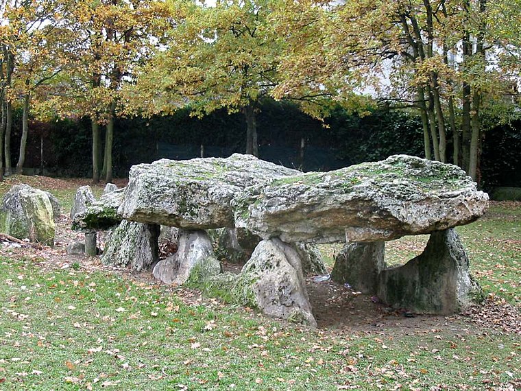
Photo: Spedona, CC BY-SA 3.0.
Allée couverte de la Justice is a park, which is situated 1 km west of Maison du Voisinage l’Étoile.

Places in the Area
Nearby places include Aubergenville and Sainte-Colombe.
Aubergenville
Town

Photo: Spedona, CC BY-SA 3.0.
Aubergenville is a commune in the Yvelines department in north-central France. It is located between Mantes-la-Jolie and Saint-Germain-en-Laye, in the valley of the Seine. This city is located near the Côteau de Montgardé on the road to Normandy.
Sainte-Colombe
Hamlet

Photo: Wikimedia, Public domain.
Sainte-Colombe is a hamlet, which is situated 3½ km south of Maison du Voisinage l’Étoile.
Issou
Village

Photo: Dolly28, CC BY-SA 3.0.
Issou is a commune in the Yvelines department, administrative region of Île-de-France, France. Issou is situated 4½ km northwest of Maison du Voisinage l’Étoile.
Maison du Voisinage l’Étoile
- Type: Community center
- Category: building
- Location: Aubergenville, Arrondissement of Mantes-la-Jolie, Yvelines, Île-de-France, France, Europe
- View on OpenStreetMap
Latitude
48.97293° or 48° 58′ 23″ northLongitude
1.84692° or 1° 50′ 49″ eastOpen location code
8FW3XRFW+5QOpenStreetMap ID
way 132357680OpenStreetMap feature
amenity=community_centreOpenStreetMap feature
building=yes
This page is based on OpenStreetMap, Wikidata, and Wikimedia Commons.
We’d love your help improving our open data sources. Thank you for contributing.
Satellite Map
Discover Maison du Voisinage l’Étoile from above in high-definition satellite imagery.
Notable Places Nearby
Highlights include Annexe Mairie d’Elisabethville and Poste Annexe.
Nearby Places
Explore places such as Crédit Agricole and Pharmacie Hoareau.
Île-de-France: Must-Visit Destinations
Delve into Paris, Versailles, Boulogne-Billancourt, and Paris Charles de Gaulle Airport.
Curious Community Centers to Discover
Uncover intriguing community centers from every corner of the globe.
About Mapcarta. Data © OpenStreetMap contributors and available under the Open Database License". Text is available under the CC BY-SA 4.0 license, except for photos, directions, and the map. Photo: Inkey, CC BY-SA 3.0.