Freiwillige Feuerwehr Remagen
Freiwillige Feuerwehr Remagen is a fire station in Remagen, Bad Neuenahr-Ahrweiler, Rhineland-Palatinate. Freiwillige Feuerwehr Remagen is situated nearby to Fightzone Remagen, as well as near the pitch Bolzplatz.| Tap on a place to explore it |
Places of Interest Nearby
Highlights include Kapelle Schwarze Madonna and Peace Museum Bridge of Remagen.
Kapelle Schwarze Madonna
Church

Photo: Nicolas17, CC BY-SA 2.5.
Kapelle Schwarze Madonna is a church, which is situated 580 metres northeast of Freiwillige Feuerwehr Remagen.
Peace Museum Bridge of Remagen
Museum
 Peace Museum Bridge of Remagen is situated 1 km north of Freiwillige Feuerwehr Remagen.
Remagen station
Railway station
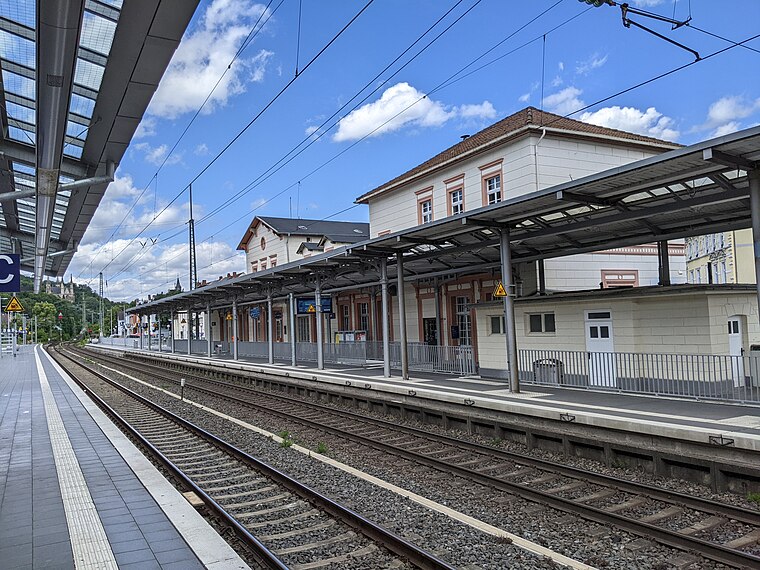
Photo: Tohma, CC BY-SA 4.0.
Remagen station is on the Left Rhine line in the city of Remagen in the German state of Rhineland-Palatinate. It is classified by Deutsche Bahn as a category 4 station. Remagen station is situated 1½ km northwest of Freiwillige Feuerwehr Remagen.
Places in the Area
Nearby places include Kripp and Erpel.

Erpel
Village

Photo: Steffen 962, CC BY-SA 4.0.
Erpel is a municipality in the district of Neuwied, in Rhineland-Palatinate, Germany.
Ockenfels
Village

Photo: Tohma, CC BY-SA 4.0.
Ockenfels is a municipality in the district of Neuwied, in Rhineland-Palatinate, Germany. Ockenfels lies in the Rhine-Westerwald Nature Park in the North of Rhineland-Palatinate. The municipality was founded in 13th century.
Freiwillige Feuerwehr Remagen
- Type: Fire station
- Location: Remagen, Bad Neuenahr-Ahrweiler, Eifel, Rhineland-Palatinate, Germany, Central Europe, Europe
- View on OpenStreetMap
Latitude
50.56883° or 50° 34′ 8″ northLongitude
7.24969° or 7° 14′ 59″ eastOpen location code
9F29H69X+GVOpenStreetMap ID
way 1328359976OpenStreetMap feature
amenity=fire_station
This page is based on OpenStreetMap, Wikidata, and Wikimedia Commons.
We’d love your help improving our open data sources. Thank you for contributing.
Satellite Map
Discover Freiwillige Feuerwehr Remagen from above in high-definition satellite imagery.
Notable Places Nearby
Highlights include Fightzone Remagen and Bolzplatz.
Nearby Places
Explore places such as ML Autoservice and Getränke Hoffmann.
Eifel: Must-Visit Destinations
Delve into Bitburg, Mayen, Nürburg, and Dernau.
Curious Fire Stations to Discover
Uncover intriguing fire stations from every corner of the globe.
About Mapcarta. Data © OpenStreetMap contributors and available under the Open Database License". Text is available under the CC BY-SA 4.0 license, except for photos, directions, and the map. Photo: Thilver, CC BY-SA 4.0.