Cimitero di Vitereta
Cimitero di Vitereta is a cemetery in Laterina Pergine Valdarno, Arezzo, Tuscany. Cimitero di Vitereta is situated nearby to the village Campogialli, as well as near the aerodrome Aviosuperficie del Borro.| Tap on a place to explore it |
Places of Interest Nearby
Highlights include Santa Maria in Campo Arsiccio and Santi Ippolito e Cassiano.
Santa Maria in Campo Arsiccio
Chapel

Photo: LigaDue, CC BY-SA 4.0.
Santa Maria in Campo Arsiccio is a chapel, which is situated 1½ km north of Cimitero di Vitereta.
Santi Ippolito e Cassiano
Church
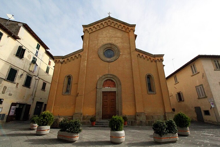
Photo: LigaDue, CC BY-SA 4.0.
Santi Ippolito e Cassiano is a church, which is situated 2½ km southeast of Cimitero di Vitereta.
San Giustino
Church

Photo: LigaDue, CC BY-SA 4.0.
San Giustino is a church, which is situated 4 km northeast of Cimitero di Vitereta.
Places in the Area
Nearby places include Vitereta and Campogialli.


Laterina
Village
 Laterina is a frazione of Laterina Pergine Valdarno in the Province of Arezzo in the Italian region Tuscany, located about 50 kilometres southeast of Florence and about 14 kilometres northwest of Arezzo. Laterina is situated 2½ km southeast of Cimitero di Vitereta.
Cimitero di Vitereta
- Type: Cemetery
- Description: cemetery in Laterina Pergine Valdarno, Italy
- Category: burial
- Location: Laterina Pergine Valdarno, Arezzo, Tuscany, Central Italy, Italy, Europe
- View on OpenStreetMap
Latitude
43.52251° or 43° 31′ 21″ northLongitude
11.68453° or 11° 41′ 4″ eastOpen location code
8FMHGMFM+2ROpenStreetMap ID
way 1330240616OpenStreetMap feature
landuse=cemeteryWikidata ID
Q130759706
This page is based on OpenStreetMap, Wikidata, and Wikimedia Commons.
We’d love your help improving our open data sources. Thank you for contributing.
Satellite Map
Discover Cimitero di Vitereta from above in high-definition satellite imagery.
In Other Languages
“Cimitero di Vitereta” goes by many names.
- Italian: “cimitero di Vitereta”
Notable Places Nearby
Highlights include Cimitero di Casanuova and Terrazza sull’Arno.
Nearby Places
Explore places such as Dal Pino and Il Folicaiolo.
Arezzo: Must-Visit Destinations
Delve into Arezzo, Cortona, Poppi, and Montevarchi.
Curious Cemeteries to Discover
Uncover intriguing cemeteries from every corner of the globe.
About Mapcarta. Data © OpenStreetMap contributors and available under the Open Database License". Text is available under the CC BY-SA 4.0 license, except for photos, directions, and the map. Photo: Wikimedia, CC0.