Boolies Wetland
Boolies Wetland is in County Meath, Leinster. Boolies Wetland is situated nearby to the locality Knockaraheen, as well as near Knocknaveagh.| Tap on a place to explore it |
Places of Interest
Highlights include Loughcrew and Slieve na Calliagh.
Loughcrew
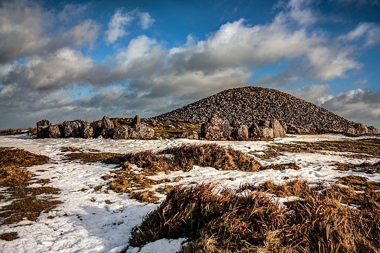
Photo: Haydn.hammerton, CC BY-SA 4.0.
Loughcrew or Lough Crew is an area of historical importance near Oldcastle, County Meath, Ireland. It is home to a group of ancient tombs from the 4th millennium BC, some decorated with rare megalithic art, which sit on top of a range of hills.
Slieve na Calliagh
Peak

Photo: Bill Griffiths, CC BY-SA 2.0.
Slieve na Calliagh are a range of hills and ancient burial site near Oldcastle, County Meath, Ireland. The summit is 276 metres, the highest point in the county.
Places in the Area
Nearby places include Oldcastle and Virginia.
Oldcastle
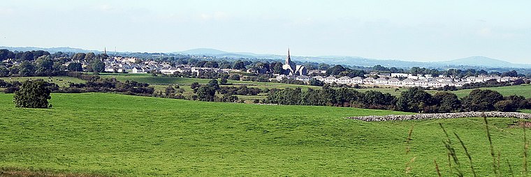
Photo: Sarah777, Public domain.
Oldcastle is a town in County Meath in central Ireland, with a population in 2022 of 1400. The reason to visit is the collection of prehistoric tombs at Loughcrew Cairns, which are as fine as those at better-known Newgrange but even older, and without the tourist hordes.
Virginia

Photo: Wikimedia, CC BY-SA 2.0.
Virginia is a small town in County Cavan in the north of the Republic of Ireland, with a population in 2022 of 3200. Like the US State, it's named for Elizabeth I, and was settled from 1612 as a "plantation" town.
Boolies Wetland
- Type: Wetland
- Category: body of water
- Location: County Meath, Leinster, East Coast and Midlands, Ireland, Britain and Ireland, Europe
- View on OpenStreetMap
Latitude
53.7761° or 53° 46′ 34″ northLongitude
-7.102° or 7° 6′ 7″ westOpen location code
9C5JQVGX+C6OpenStreetMap ID
way 1330608360OpenStreetMap feature
natural=wetland
This page is based on OpenStreetMap, Wikidata, and Wikimedia Commons.
We’d love your help improving our open data sources. Thank you for contributing.
Satellite Map
Discover Boolies Wetland from above in high-definition satellite imagery.
Localities in the Area
Explore places such as Knockaraheen and Knocknaveagh.
Notable Places Nearby
Highlights include St. Patrick’s Well and Drumlerry Wetland.
County Meath: Must-Visit Destinations
Delve into Navan, Brú Na Bóinne Archaeological Park, Kells, and Trim.
Curious Places to Discover
Uncover intriguing places from every corner of the globe.
About Mapcarta. Data © OpenStreetMap contributors and available under the Open Database License". Text is available under the CC BY-SA 4.0 license, except for photos, directions, and the map. Photo: Guenni, CC BY-SA 3.0.