Magic Sands Mobile Home Park
Magic Sands Mobile Home Park is a residential area in Stanislaus County, San Joaquin Valley, California which is located on North Soderquist Road. Magic Sands Mobile Home Park is situated nearby to the cemetery Turlock Memorial Park, as well as near Soderquist Park.| Tap on a place to explore it |
Places of Interest Nearby
Highlights include Emanuel Medical Center and Turlock High School.
Emanuel Medical Center
Hospital
Emanuel Medical Center is a 209-bed acute care hospital located in Turlock, Calif. Hospital services include 24-hour emergency care, the only heart attack receiving center between Modesto and Fresno, an advanced center for mothers and newborns, rehabilitation and therapy, and more. Emanuel Medical Center is situated 1½ miles northeast of Magic Sands Mobile Home Park.
Turlock High School
School
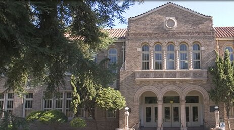
Photo: goldleviathan, CC BY 3.0.
Turlock High School is a comprehensive high school located in Turlock, in the heart of the northern San Joaquin Valley in the U.S. state of California. Turlock High School is situated 2 miles east of Magic Sands Mobile Home Park.
Places in the Area
Nearby places include Turlock and Denair.
Turlock
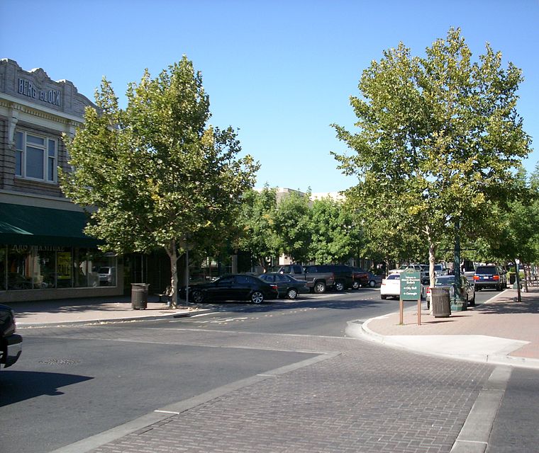
Photo: Intothewoods29, Public domain.
Turlock is in California's San Joaquin Valley. It is the home of California State University Stanislaus.
Denair
Village

Photo: Pi.1415926535, CC BY-SA 4.0.
Denair is a census-designated place in Stanislaus County, California, United States. The population was 4,865 at the 2020 census, up from 4,404 at the 2010 census. It is part of the Modesto Metropolitan Statistical Area. Denair is situated 4 miles northeast of Magic Sands Mobile Home Park.
Keyes
Locality
Keyes is a census-designated place in Stanislaus County, California, United States. The population was 5,672 at the 2020 census, up from 5,601 at the 2010 census. It is part of the Modesto Metropolitan Statistical Area. Keyes is situated 5 miles northwest of Magic Sands Mobile Home Park.
Magic Sands Mobile Home Park
- Type: Residential area
- Address: 677 North Soderquist Road, Turlock, CA 95380
- Location: Stanislaus County, San Joaquin Valley, California, United States, North America
- View on OpenStreetMap
Latitude
37.49857° or 37° 29′ 55″ northLongitude
-120.8639° or 120° 51′ 50″ westOpen location code
849XF4XP+CCOpenStreetMap ID
way 1337841678OpenStreetMap feature
landuse=residential
This page is based on OpenStreetMap, Wikidata, and Wikimedia Commons.
We’d love your help improving our open data sources. Thank you for contributing.
Satellite Map
Discover Magic Sands Mobile Home Park from above in high-definition satellite imagery.
Notable Places Nearby
Highlights include Turlock Memorial Park and Soderquist Park.
Nearby Places
Explore places such as Soderquist & Canal and Turlock Funeral Home.
Stanislaus County: Must-Visit Destinations
Delve into Modesto, Turlock, Oakdale, and Patterson.
Curious Residential Areas to Discover
Uncover intriguing residential areas from every corner of the globe.
About Mapcarta. Data © OpenStreetMap contributors and available under the Open Database License". Text is available under the CC BY-SA 4.0 license, except for photos, directions, and the map. Photo: Wikimedia, CC0.