Rheinstadion
Rheinstadion is a stadium in Bas-Rhin, Grand Est. Rheinstadion is situated nearby to the sports venue Kehler FV, as well as near the motorhome stopover Wohnmobilstellplatz Am Wasserturm.| Tap on a place to explore it |
Places of Interest Nearby
Highlights include Weißtannenturm and Jardin des Deux Rives.
Weißtannenturm

Photo: AlterVista, CC BY-SA 3.0.
Weißtannenturm is situated 330 metres northwest of Rheinstadion.
Jardin des Deux Rives
Park

Photo: Remi.leblond, CC BY 3.0.
Jardin des Deux Rives is a park, which is situated 1 km northwest of Rheinstadion.
Stadthalle Kehl
Community center
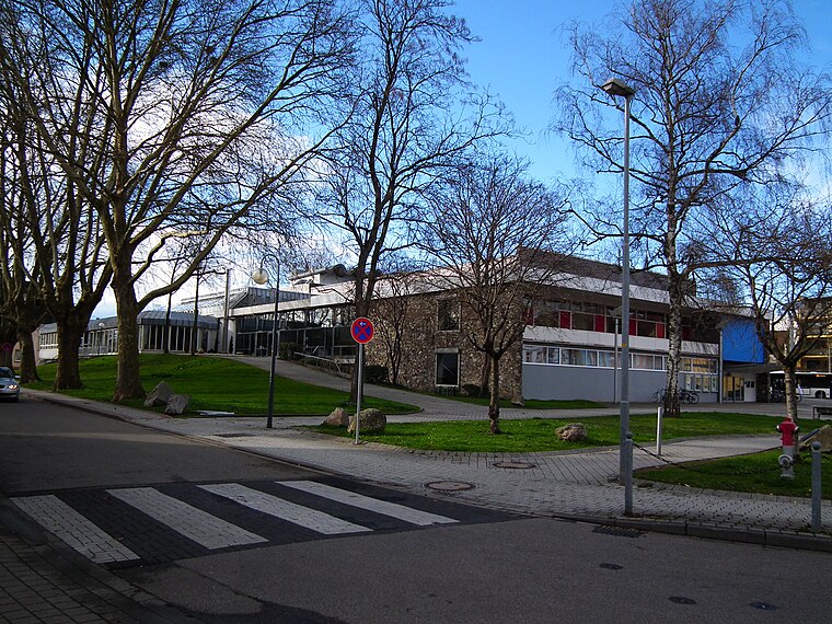
Photo: 4028mdk09, CC BY-SA 3.0.
Stadthalle Kehl is a community center, which is situated 1 km north of Rheinstadion.
Places in the Area
Nearby places include Kehl and Neuhof.
Kehl

Photo: Wikimedia, CC BY-SA 4.0.
Kehl is a city on the River Rhine, in the Ortenau region of Germany west of the Black Forest and immediately east of Strasbourg.
Neuhof
Suburb
Neuhof is a suburb in the southern district of the French city of Strasbourg. Administratively, it is part of "Neuhof, Stockfeld, Ganzau" one of the ten districts of Strasbourg. Neuhof is situated 4 km southwest of Rheinstadion.
Strasbourg

Photo: stefano Merli, CC BY-SA 2.0.
Strasbourg, in Alsace, is the capital of the Grand-Est region of France and is most widely known for hosting a number of important European institutions.
Rheinstadion
- Type: Stadium
- Description: building in Kehl, Freiburg Government Region, Bade-Württemberg, Germany
- Categories: association football venue, recreation area, sports location, tourist attraction, and tourism
- Location: Bas-Rhin, Grand Est, France, Europe
- View on OpenStreetMap
Latitude
48.56282° or 48° 33′ 46″ northLongitude
7.81157° or 7° 48′ 42″ eastOpen location code
8FW9HR76+4JOpenStreetMap ID
way 1338646903OpenStreetMap feature
leisure=stadiumOpenStreetMap feature
sport=multiWikidata ID
Q2147955
This page is based on OpenStreetMap, Wikidata, and Wikimedia Commons.
We’d love your help improving our open data sources. Thank you for contributing.
Satellite Map
Discover Rheinstadion from above in high-definition satellite imagery.
In Other Languages
“Rheinstadion” goes by many names.
- German: “Rheinstadion (Kehl)”
- German: “Rheinstadion”
Notable Places Nearby
Highlights include Kehler FV and Wohnmobilstellplatz Am Wasserturm.
Nearby Places
Explore places such as Stadiongaststätte Kehler FV and Kehl, Am Stadion.
Grand Est: Must-Visit Destinations
Delve into Strasbourg, Reims, Metz, and Nancy.
Curious Stadiums to Discover
Uncover intriguing stadiums from every corner of the globe.
About Mapcarta. Data © OpenStreetMap contributors and available under the Open Database License". Text is available under the CC BY-SA 4.0 license, except for photos, directions, and the map. Photo: Apeto, CC BY 3.0.