Projet Le 20
Projet Le 20 is in Hardricourt, Arrondissement of Mantes-la-Jolie, Île-de-France. Projet Le 20 is situated nearby to the railway station Meulan - Hardricourt, as well as near the park Square barry callebaut.| Tap on a place to explore it |
Places of Interest Nearby
Highlights include Gare de Meulan - Hardricourt and Église Saint-Germain-de-Paris de Hardricourt.
Gare de Meulan - Hardricourt
Railway stop

Photo: Spedona, CC BY-SA 3.0.
Gare de Meulan - Hardricourt is a railway stop, which is situated 140 metres southeast of Projet Le 20.
Église Saint-Germain-de-Paris de Hardricourt
Church

Photo: Spedona, CC BY-SA 3.0.
Église Saint-Germain-de-Paris de Hardricourt is a church, which is situated 460 metres west of Projet Le 20.
Église Saint-Nicolas de Meulan-en-Yvelines
Church

Photo: Spedona, CC BY-SA 3.0.
Église Saint-Nicolas de Meulan-en-Yvelines is a church, which is situated 560 metres east of Projet Le 20.
Places in the Area
Nearby places include Meulan-en-Yvelines and Les Mureaux.
Meulan-en-Yvelines
Village

Photo: Spedona, CC BY-SA 3.0.
Meulan-en-Yvelines is a commune in the Yvelines department in the Île-de-France region in north-central France. It hosted part of the sailing events for the 1900 Summer Olympics held in neighbouring Paris, and would do so again 24 years later.
Les Mureaux
Town
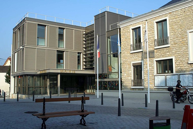
Photo: Spedona, CC BY-SA 3.0.
Les Mureaux is a commune in the Yvelines department in the Île-de-France region in north-central France. It is located in the north-western suburbs of Paris, 35.9 km from the centre of Paris.
Jambville
Village

Photo: Felouch Kotek, CC BY-SA 3.0.
Jambville is a commune in the Yvelines department in the Île-de-France region in north-central France. It is 50 kilometres to the north west of Paris in the heart of the Vexin national park. Château de Jambville is the Centre national de formation des Scouts et Guides de France. Jambville is situated 6 km northwest of Projet Le 20.
Projet Le 20
- Type: Construction
- Location: Hardricourt, Arrondissement of Mantes-la-Jolie, Yvelines, Île-de-France, France, Europe
- View on OpenStreetMap
Latitude
49.00671° or 49° 0′ 24″ northLongitude
1.90056° or 1° 54′ 2″ eastOperator
LivinxOpen location code
8FX32W42+M6OpenStreetMap ID
way 1344589658OpenStreetMap feature
landuse=construction
This page is based on OpenStreetMap, Wikidata, and Wikimedia Commons.
We’d love your help improving our open data sources. Thank you for contributing.
Satellite Map
Discover Projet Le 20 from above in high-definition satellite imagery.
Notable Places Nearby
Highlights include Meulan - Hardricourt and Place Lieutenant Martin.
Nearby Places
Explore places such as Les 1000 Pattes and Gare de Meulan-Hardricourt.
Île-de-France: Must-Visit Destinations
Delve into Paris, Versailles, Boulogne-Billancourt, and Paris Charles de Gaulle Airport.
Curious Places to Discover
Uncover intriguing places from every corner of the globe.
About Mapcarta. Data © OpenStreetMap contributors and available under the Open Database License". Text is available under the CC BY-SA 4.0 license, except for photos, directions, and the map. Photo: Inkey, CC BY-SA 3.0.