Puente de la Lira
Puente de la Lira is a bridge in Madrid, Community of Madrid. Puente de la Lira is situated nearby to Plaza de Perseo, as well as near the pitch Instalación Deportiva Municipal Básica Virgen de la Estrella.| Tap on a place to explore it |
Places of Interest Nearby
Highlights include Estrella and RESAD.
Estrella
Metro station

Photo: Braniff747SP, CC BY-SA 3.0.
Estrella is a station on Line 9 of the Madrid Metro, serving the Estrella barrio. It is located in fare Zone A. The station is located directly below the M-30 Autopista, between the districts of Moratalaz to the east and Retiro to the west, and has entrances on both sides. Estrella is situated 360 metres northeast of Puente de la Lira.
RESAD
College
 The Real Escuela Superior de Arte Dramático is a drama school in Madrid, Spain. RESAD is situated 1 km west of Puente de la Lira.
Conde de Casal
Metro station
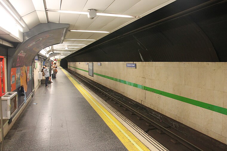
Photo: Draceane, CC BY-SA 4.0.
Conde de Casal is a station on Line 6 of the Madrid Metro, located under the Plaza del Conde de Casal. It is located in fare Zone A. Conde de Casal is situated 530 metres west of Puente de la Lira.
Places in the Area
Nearby places include Estrella and Media Legua.
Estrella
Quarter
Estrella is an administrative neighborhood of Madrid belonging to the district of Retiro. It has an area of 1.025805 km2. As of 1 March 2020, it has a population of 23,474.
Media Legua
Quarter

Photo: Wikimedia, CC BY-SA 2.5.
Media Legua is an administrative neighborhood of Madrid belonging to the district of Moratalaz. It has an area of 0.999539 km2. As of 1 March 2020, it has a population of 17,977.
Niño Jesús
Quarter

Photo: Ricardo Ricote Rodrí…, CC BY 3.0.
Niño Jesús is an administrative neighborhood of Madrid belonging to the district of Retiro. It is 0.643202 km² in size.
Puente de la Lira
- Type: Bridge
- Category: transportation
- Location: Madrid, Madrid, Community of Madrid, Central Spain, Spain, Iberia, Europe
- View on OpenStreetMap
Latitude
40.40874° or 40° 24′ 32″ northLongitude
-3.66404° or 3° 39′ 51″ westOpen location code
8CGRC85P+F9OpenStreetMap ID
way 1346129329OpenStreetMap feature
man_made=bridge
This page is based on OpenStreetMap, Wikidata, and Wikimedia Commons.
We’d love your help improving our open data sources. Thank you for contributing.
Satellite Map
Discover Puente de la Lira from above in high-definition satellite imagery.
Notable Places Nearby
Highlights include Plaza de Perseo and Instalación Deportiva Municipal Básica Virgen de la Estrella.
Nearby Places
Explore places such as Escuela Infantil Privada Bambi y Tambor and Talleres Miguel (Bosch Car Service).
Madrid: Must-Visit Destinations
Delve into Sol-Letras-Lavapiés, Salamanca, Retiro-Paseo del Arte, and Chamberí-Castellana.
Curious Bridges to Discover
Uncover intriguing bridges from every corner of the globe.
About Mapcarta. Data © OpenStreetMap contributors and available under the Open Database License". Text is available under the CC BY-SA 4.0 license, except for photos, directions, and the map. Photo: DonPaolo, CC BY-SA 3.0.