Bassin Vauban 2
Bassin Vauban 2 is a dock in Toulon, Var, Provence-Alpes-Côte d’Azur. Bassin Vauban 2 is situated nearby to the dock Bassin Vauban 3, as well as near Bassin Vauban 1.| Tap on a place to explore it |
Places of Interest Nearby
Highlights include National Maritime Museum and Hôtel de Ville, Toulon.
National Maritime Museum
Museum
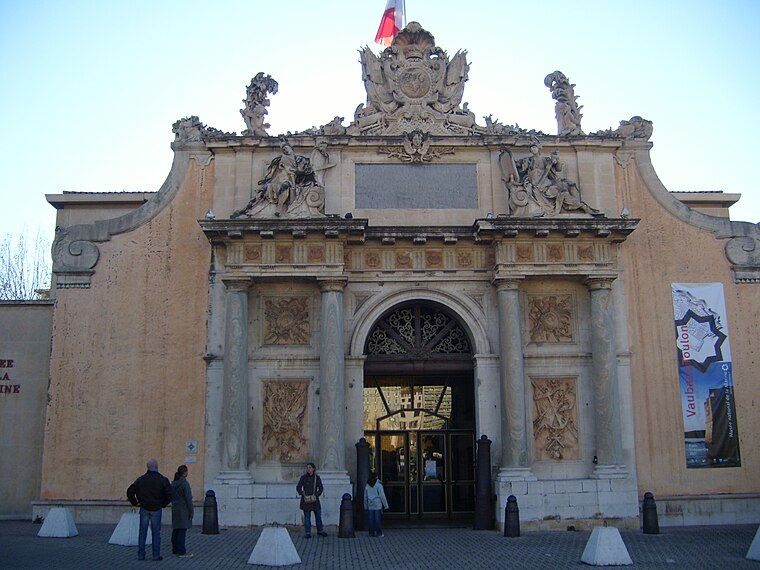
Photo: SiefkinDR, Public domain.
National Maritime Museum is situated 360 metres northeast of Bassin Vauban 2.
Hôtel de Ville, Toulon
Town hall

Photo: Chabe01, CC BY-SA 4.0.
The Hôtel de Ville is a historic building in Toulon, Var, southern France, standing on Avenue de la République. Hôtel de Ville, Toulon is situated 540 metres east of Bassin Vauban 2.
Stade Mayol
Stadium

Photo: Johnjohn83var, Public domain.
The Stade Mayol is a multi-purpose stadium in Toulon, France. It is currently used mostly for rugby union matches and is the home stadium of RC Toulonnais. Stade Mayol is situated 1 km east of Bassin Vauban 2.
Places in the Area
Nearby places include Basse Ville and Le Mourillon.

Le Mourillon
Suburb

Photo: Maisrimer, Public domain.
Le Mourillon is a neighbourhood to the east of the French city of Toulon, near the entrance to the Rade or roadstead. It was once a fishing village, and then became the home of many of the officers of the French fleet and to part of the naval dockyard.
Cap Brun
Suburb

Photo: Adltbc92, CC BY-SA 3.0.
Cap Brun is a suburb, which is situated 3½ km east of Bassin Vauban 2.
Bassin Vauban 2
- Type: Dock
- Category: transportation
- Location: Toulon, Arrondissement of Toulon, Var, Provence-Alpes-Côte d’Azur, France, Europe
- View on OpenStreetMap
Latitude
43.11902° or 43° 7′ 9″ northLongitude
5.92617° or 5° 55′ 34″ eastOpen location code
8FM74W9G+JFOpenStreetMap ID
way 1348681628OpenStreetMap feature
waterway=dock
This page is based on OpenStreetMap, Wikidata, and Wikimedia Commons.
We’d love your help improving our open data sources. Thank you for contributing.
Satellite Map
Discover Bassin Vauban 2 from above in high-definition satellite imagery.
Notable Places Nearby
Highlights include Bassin Vauban 3 and Bassin Vauban 1.
Nearby Places
Explore places such as Vauban (Base Navale) and Bassins Vauban.
Var: Must-Visit Destinations
Delve into Saint-Tropez, Hyères, Fréjus, and Saint-Raphaël.
Curious Docks to Discover
Uncover intriguing docks from every corner of the globe.
About Mapcarta. Data © OpenStreetMap contributors and available under the Open Database License". Text is available under the CC BY-SA 4.0 license, except for photos, directions, and the map. Photo: yves Tennevin, CC BY 2.0.