Café-tabac de la Gare
Café-tabac de la Gare is a bar in Sainte-Geneviève-des-Bois, Arrondissement of Palaiseau, Île-de-France. Café-tabac de la Gare is situated nearby to the railway station Sainte-Geneviève-des-Bois, as well as near the marketplace Marché de la Gare.| Tap on a place to explore it |
Places of Interest Nearby
Highlights include Sainte-Geneviève-des-Bois station and Église Saint-Jean-Marie-Vianney de Sainte-Geneviève-des-Bois.
Sainte-Geneviève-des-Bois station
Railway station
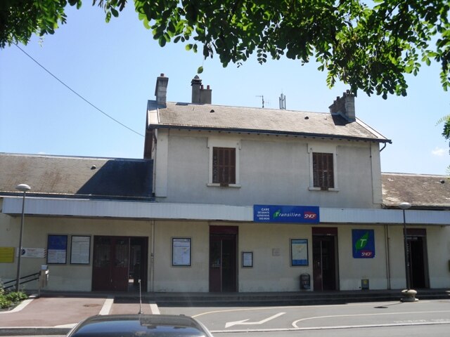
Photo: Cyrilb1881, CC BY-SA 3.0.
Sainte-Geneviève-des-Bois is a railway station in Sainte-Geneviève-des-Bois, Essonne, Paris, France. The station was opened in 1881 and is on the Paris–Bordeaux railway.
Église Saint-Jean-Marie-Vianney de Sainte-Geneviève-des-Bois
Church

Photo: Cyrilb1881, CC BY-SA 3.0.
Église Saint-Jean-Marie-Vianney de Sainte-Geneviève-des-Bois is a church, which is situated 400 metres south of Café-tabac de la Gare.
Town hall of Villiers-sur-Orge
Town hall

Photo: Jo simons, Public domain.
Town hall of Villiers-sur-Orge is situated 1 km northwest of Café-tabac de la Gare.
Places in the Area
Nearby places include Sainte-Geneviève-des-Bois and Villemoisson-sur-Orge.
Sainte-Geneviève-des-Bois
Town

Photo: Jcognard, Public domain.
Sainte-Geneviève-des-Bois is a commune in the southern suburbs of Paris, France. It is located 23.5 km from the center of Paris, in the arrondissement of Palaiseau, Essonne department, Île-de-France.
Villemoisson-sur-Orge
Village
 Villemoisson-sur-Orge is a commune in the Essonne department in Île-de-France in northern France.
Épinay-sur-Orge
Town

Photo: Cyrilb1881, CC BY-SA 4.0.
Épinay-sur-Orge is a commune in the Essonne department in Île-de-France in northern France. It is situated near Orly Airport some 17 km south of Paris on the A6 motorway.
Café-tabac de la Gare
- Type: Bar
- Category: building
- Location: Sainte-Geneviève-des-Bois, Arrondissement of Palaiseau, Essonne, Île-de-France, France, Europe
- View on OpenStreetMap
Latitude
48.6532° or 48° 39′ 12″ northLongitude
2.31259° or 2° 18′ 45″ eastOpen location code
8FW4M837+72OpenStreetMap ID
way 135597811OpenStreetMap feature
amenity=barOpenStreetMap feature
building=yes
This page is based on OpenStreetMap, Wikidata, and Wikimedia Commons.
We’d love your help improving our open data sources. Thank you for contributing.
Satellite Map
Discover Café-tabac de la Gare from above in high-definition satellite imagery.
Notable Places Nearby
Highlights include Sainte-Geneviève-des-Bois and Marché de la Gare.
Nearby Places
Explore places such as Guichet Transilien and Sainte-Geneviève-des-Bois Railway Station.
Île-de-France: Must-Visit Destinations
Delve into Paris, Versailles, Boulogne-Billancourt, and Paris Charles de Gaulle Airport.
Curious Bars to Discover
Uncover intriguing bars from every corner of the globe.
About Mapcarta. Data © OpenStreetMap contributors and available under the Open Database License". Text is available under the CC BY-SA 4.0 license, except for photos, directions, and the map. Photo: Olybrius, CC BY-SA 3.0.