Geffery’s Homes
Geffery’s Homes is a residential building in Bromley, Greater London, England which is located on Mottingham Road. Geffery’s Homes is situated nearby to the community center Geffery’s Hall Community Centre, as well as near Wynford Park.| Tap on a place to explore it |
Places of Interest Nearby
Highlights include Coldharbour Library and Eltham Palace.
Coldharbour Library
Library

Photo: Mike Faherty, CC BY-SA 2.0.
Coldharbour Library is situated 2,100 feet east of Geffery’s Homes.
Eltham Palace
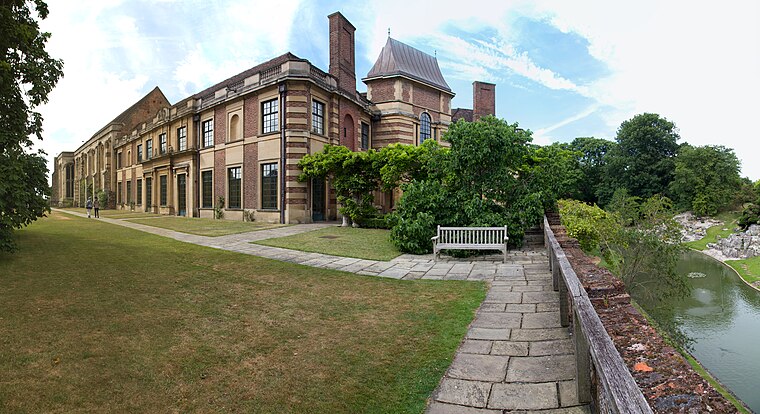
Photo: Tom Parnell, CC BY-SA 2.0.
Eltham Palace is a large house at Eltham in southeast London, England, within the Royal Borough of Greenwich. The house consists of the medieval great hall of a former royal residence, to which an Art Deco extension was added in the 1930s. Eltham Palace is situated 1 mile north of Geffery’s Homes.
Mottingham Library
Library

Photo: David Anstiss, CC BY-SA 2.0.
Mottingham Library is situated 2,200 feet northwest of Geffery’s Homes.
Places in the Area
Nearby places include Mottingham and Coldharbour.
Mottingham
Suburb

Photo: Stacey Harris, CC BY-SA 2.0.
Mottingham is a district of south-east London, England, which straddles the border of the London Borough of Bromley, the London Borough of Lewisham and the Royal Borough of Greenwich.
Coldharbour
Suburb

Photo: Dr Neil Clifton, CC BY-SA 2.0.
Coldharbour is an area of South East London and post-war housing estate within the Royal Borough of Greenwich. It is located to the south of Eltham and north of Chislehurst.
Chinbrook
Suburb

Photo: Philip Talmage, CC BY-SA 2.0.
Chinbrook is an area of south east London, England, located 14 km southeast of Charing Cross in the London Borough of Lewisham. Chinbrook lies between Grove Park and Mottingham, approximately half a mile east of Grove Park centre and is generally considered part of Grove Park.
Geffery’s Homes
- Type: Residential building
- Address: 158 Mottingham Road, Mottingham
- Category: building
- Location: Bromley, Greater London, England, United Kingdom, Britain and Ireland, Europe
- View on OpenStreetMap
Latitude
51.43247° or 51° 25′ 57″ northLongitude
0.04868° or 0° 2′ 55″ eastLevels
2Open location code
9F32C2JX+XFOpenStreetMap ID
way 1363189762OpenStreetMap feature
building=residential
This page is based on OpenStreetMap, Wikidata, and Wikimedia Commons.
We’d love your help improving our open data sources. Thank you for contributing.
Satellite Map
Discover Geffery’s Homes from above in high-definition satellite imagery.
Notable Places Nearby
Highlights include Geffery’s Hall Community Centre and Wynford Park.
Nearby Places
Explore places such as Geffery’s Court and Mottingham / Prince Of Wales.
England: Must-Visit Destinations
Delve into London, Manchester, Sheffield, and Leeds.
Curious Residential Buildings to Discover
Uncover intriguing residential buildings from every corner of the globe.
About Mapcarta. Data © OpenStreetMap contributors and available under the Open Database License". Text is available under the CC BY-SA 4.0 license, except for photos, directions, and the map. Photo: Mario modesto, CC BY-SA 3.0.