Chalet le Canotier
Chalet le Canotier is a chalet in Quebec, Canada. Chalet le Canotier is situated nearby to the island Île du Sabot, as well as near Tir à l’arc.| Tap on a place to explore it |
Places in the Area
Nearby places include Saint-Paulin and Saint-Élie-de-Caxton.
Saint-Paulin
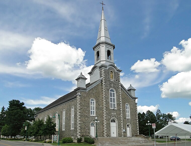
Photo: Bgag, CC BY-SA 4.0.
Saint-Paulin is a parish municipality of the Maskinongé Regional county municipality, in Basse-Mauricie, Quebec, Canada. In addition to the main village, the municipal territory includes in its northern part the hamlet of Hunterstown, located upstream from…
Saint-Élie-de-Caxton

Photo: Fralambert, CC BY-SA 4.0.
Saint-Élie-de-Caxton is a parish municipality of the Maskinongé Regional county municipality, in Moyenne-Mauricie. This locality is experiencing a growing resort.
Charette

Photo: Bgag, CC BY-SA 3.0.
Charette is a parish municipality of the Maskinongé Region, in Basse-Mauricie, in Quebec, Canada.
Chalet le Canotier
- Type: Chalet
- Categories: building, tourism, and accommodation
- Location: Quebec, Canada, North America
- View on OpenStreetMap
Latitude
46.45302° or 46° 27′ 11″ northLongitude
-73.01121° or 73° 0′ 40″ westBrand
Le Baluchon Éco-villégiatureOpen location code
87R8FX3Q+6GOpenStreetMap ID
way 1367351312OpenStreetMap feature
building=yesOpenStreetMap feature
tourism=chalet
This page is based on OpenStreetMap, Wikidata, and Wikimedia Commons.
We’d love your help improving our open data sources. Thank you for contributing.
Satellite Map
Discover Chalet le Canotier from above in high-definition satellite imagery.
Notable Places Nearby
Highlights include Île du Sabot and Tir à l’arc.
Nearby Places
Explore places such as Auberge Damphousse and SPA santé.
Quebec: Must-Visit Destinations
Delve into Montreal, Gaspé, Quebec City, and Percé.
Curious Chalets to Discover
Uncover intriguing chalets from every corner of the globe.
About Mapcarta. Data © OpenStreetMap contributors and available under the Open Database License". Text is available under the CC BY-SA 4.0 license, except for photos, directions, and the map. Photo: Taxiarchos228, CC BY-SA 3.0.