The Hills Merano
The Hills Merano is an apartment building in Merano, South Tyrol, Trentino-Alto Adige. The Hills Merano is situated nearby to the sports venue Fighting Club Meran/o, as well as near the water park Wasserpark Dorf Tirol - Parco acquatico Tirolo.| Tap on a place to explore it |
Places of Interest Nearby
Highlights include Women’s Museum Merano and Princely Castle.
Women’s Museum Merano
Museum
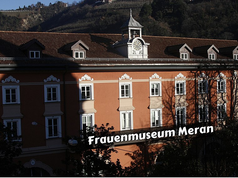
Photo: Museia16, CC BY-SA 4.0.
The Women's Museum Merano is located in a former convent of the Poor Clares in the centre of Meran. It is administrated by an association and is also the registration office of the International Association of Women's Museums. Women’s Museum Merano is situated 670 metres south of The Hills Merano.
Princely Castle
Castle

Photo: ManfredK, CC BY-SA 3.0.
Princely Castle is situated 710 metres south of The Hills Merano.
Merano Arte
Museum

Photo: ManfredK, CC BY-SA 4.0.
Merano Arte is a museum, which is situated 1 km south of The Hills Merano.
Places in the Area
Nearby places include Tirol and Algund.
Tirol
Village

Photo: Lord Koxinga, CC BY-SA 3.0.
Tirol is a comune in the province of South Tyrol in northern Italy, located about 25 kilometres northwest of the city of Bolzano.
Algund
Village

Photo: Thesurvived99, CC BY-SA 3.0.
Algund is a comune in South Tyrol in northern Italy, located about 25 kilometres northwest of Bolzano. Algund is situated 3 km west of The Hills Merano.
Sinich
Village

Photo: Llorenzi, Public domain.
Sinich is a village, which is situated 4 km southeast of The Hills Merano.
The Hills Merano
- Type: Apartment building
- Address: 19
- Categories: building and residential building
- Location: Merano, South Tyrol, Trentino-Alto Adige, Northeast Italy, Italy, Europe
- View on OpenStreetMap
Latitude
46.6787° or 46° 40′ 43″ northLongitude
11.15914° or 11° 9′ 33″ eastOpen location code
8FRHM5H5+FMOpenStreetMap ID
way 1368377618OpenStreetMap feature
building=apartments
This page is based on OpenStreetMap, Wikidata, and Wikimedia Commons.
We’d love your help improving our open data sources. Thank you for contributing.
Satellite Map
Discover The Hills Merano from above in high-definition satellite imagery.
Notable Places Nearby
Highlights include Fighting Club Meran/o and Wasserpark Dorf Tirol - Parco acquatico Tirolo.
Nearby Places
Explore places such as Bellinistraße - Via Bellini and Bellinistraße - Via Bellini.
South Tyrol: Must-Visit Destinations
Delve into Bolzano, Brixen, Bruneck, and Sterzing.
Curious Apartment Buildings to Discover
Uncover intriguing apartment buildings from every corner of the globe.
About Mapcarta. Data © OpenStreetMap contributors and available under the Open Database License". Text is available under the CC BY-SA 4.0 license, except for photos, directions, and the map. Photo: Wikimedia, CC BY-SA 3.0.