Goodyer Meadows
Goodyer Meadows is a nature reserve in Petersfield, East Hampshire, England. Goodyer Meadows is situated nearby to the suburb Causeway, as well as near Heath Common.| Tap on a place to explore it |
Places of Interest
Highlights include Petersfield railway station and Petersfield Museum.
Petersfield railway station
Railway station
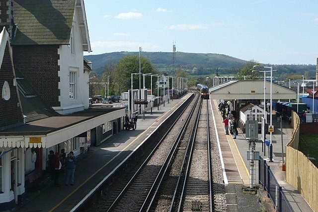
Photo: Graham Horn, CC BY-SA 2.0.
Petersfield railway station serves the market town of Petersfield, Hampshire, England. It is on the Portsmouth Direct line, 54 miles 71 chains down the line from London Waterloo via Woking.
Petersfield Museum
Museum

Photo: Hassocks5489, CC0.
Petersfield Museum and Art Gallery is a museum and arts institution in the ancient market town of Petersfield in Hampshire, England. Established in 1999, Petersfield Museum and Art Gallery is an accredited independent museum and is a registered charity that has evolved into a centre for the arts, history and hosts community events.
Petersfield Hospital
Hospital

Photo: Martyn Pattison, CC BY-SA 2.0.
Petersfield Hospital is a health facility in Swan Street, Petersfield, Hampshire, England. It is managed by Southern Health NHS Foundation Trust.
Places in the Area
Nearby places include Weston and South Harting.
Weston
Hamlet
Weston is a hamlet in the East Hampshire district of Hampshire, England. It is in the civil parish of Buriton. It is 1.4 miles southwest of Petersfield. The nearest railway station is Petersfield, 1.4 miles northeast of the village.
South Harting
Village

Photo: Charlesdrakew, Public domain.
South Harting is a village within Harting civil parish in the Chichester district of West Sussex, England. It lies on the B2146 road, 4 miles southeast of Petersfield in Hampshire.
Nursted
Hamlet
Nursted is a hamlet in the civil parish of Buriton, in the East Hampshire district of Hampshire, England. It is 1.8 miles southeast of Petersfield, on the B21466 road.
Goodyer Meadows
- Type: Nature reserve
- Category: recreation area
- Location: Petersfield, East Hampshire, Hampshire, South East England, England, United Kingdom, Britain and Ireland, Europe
- View on OpenStreetMap
Latitude
50.9962° or 50° 59′ 46″ northLongitude
-0.9331° or 0° 55′ 59″ westOpen location code
9C2XX3W8+FPOpenStreetMap ID
way 1374257949OpenStreetMap feature
leisure=nature_reserve
This page is based on OpenStreetMap, Wikidata, and Wikimedia Commons.
We’d love your help improving our open data sources. Thank you for contributing.
Satellite Map
Discover Goodyer Meadows from above in high-definition satellite imagery.
Localities in the Area
Explore places such as Causeway and Heath Common.
Notable Places Nearby
Highlights include Balancing Pond and South Petersfield Golf Club.
Hampshire: Must-Visit Destinations
Delve into Southampton, Portsmouth, Winchester, and Farnborough.
Curious Nature Reserves to Discover
Uncover intriguing nature reserves from every corner of the globe.
About Mapcarta. Data © OpenStreetMap contributors and available under the Open Database License". Text is available under the CC BY-SA 4.0 license, except for photos, directions, and the map. Photo: Bashereyre, CC BY-SA 3.0.