Highbridge Medical Centre - Car Park
Highbridge Medical Centre - Car Park is a parking area in Burnham-on-Sea and Highbridge, Sedgemoor District, England. Highbridge Medical Centre - Car Park is situated nearby to the pitch Astroturf, as well as near The King Alfred School.| Tap on a place to explore it |
Places of Interest Nearby
Highlights include The King Alfred School and St John the Evangelist.
The King Alfred School
School
 The King Alfred School is a coeducational secondary school and sixth form located in Highbridge, Somerset, England. It is an academy and part of The Priory Learning Trust. The King Alfred School is situated 820 feet west of Highbridge Medical Centre - Car Park.
St John the Evangelist
Church
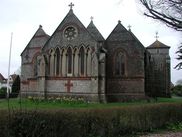
Photo: ChurchCrawler, CC BY-SA 2.0.
St John the Evangelist is a church, which is situated 1,600 feet southeast of Highbridge Medical Centre - Car Park.
River Brue
River
 The River Brue originates in the parish of Brewham in Somerset, England, and reaches the sea some 50 kilometres west at Burnham-on-Sea. It originally took a different route from Glastonbury to the sea, but this was changed by Glastonbury Abbey in the twelfth century.
Places in the Area
Nearby places include Highbridge and Burnham-on-Sea.
Highbridge
Town
Photo: ChurchCrawler, CC BY-SA 2.0.
Highbridge is a historic market town on the edge of the Somerset Levels near the mouth of the River Brue in the county of Somerset, England. It is 20 miles northeast of Taunton and 7 miles north of Bridgwater.
Burnham-on-Sea
Town

Photo: Wikimedia, CC BY-SA 2.0.
Burnham-on-Sea is a seaside town in Somerset, England, at the mouth of the River Parrett, upon Bridgwater Bay. Burnham was a small fishing village until the late 18th century when it began to grow because of its popularity as a seaside resort.
Huntspill
Village

Photo: ChurchCrawler, CC BY-SA 2.0.
Huntspill is a village and former civil parish on the Huntspill Level in Somerset, England. It lies on the A38 road, 1.5 miles south of Highbridge. The village is the principal settlement in the civil parish of West Huntspill. Huntspill is situated 1½ miles south of Highbridge Medical Centre - Car Park.
Highbridge Medical Centre - Car Park
- Type: Parking area
- Parking: surface
- Category: transportation
- Location: Burnham-on-Sea and Highbridge, Sedgemoor District, Somerset, West Country, England, United Kingdom, Britain and Ireland, Europe
- View on OpenStreetMap
Latitude
51.22758° or 51° 13′ 39″ northLongitude
-2.97876° or 2° 58′ 44″ westOpen location code
9C3V62HC+2FOpenStreetMap ID
way 1375708777OpenStreetMap feature
amenity=parkingOpenStreetMap attribute
parking=surface
This page is based on OpenStreetMap, Wikidata, and Wikimedia Commons.
We’d love your help improving our open data sources. Thank you for contributing.
Satellite Map
Discover Highbridge Medical Centre - Car Park from above in high-definition satellite imagery.
Notable Places Nearby
Highlights include Astroturf and Gospel Centre.
Nearby Places
Explore places such as Highbridge Medical Centre - Car Park and G Block.
Somerset: Must-Visit Destinations
Delve into Bristol, Bath, Wells, and Taunton.
Curious Parking Areas to Discover
Uncover intriguing parking areas from every corner of the globe.
About Mapcarta. Data © OpenStreetMap contributors and available under the Open Database License". Text is available under the CC BY-SA 4.0 license, except for photos, directions, and the map. Photo: matthewhartley369, CC BY-SA 2.0.