Escuela La Chocota
Escuela La Chocota is a school in Valparaíso Region, Chile which is located on Camino Horcón-Ventanas. Escuela La Chocota is situated nearby to the pitch Cancha Fútbol Horcón, as well as near the town Las Ventanas.| Tap on a place to explore it |
Places of Interest Nearby
Highlights include Ventanas Power Plant and Cau Cau.
Ventanas Power Plant
Power station
Ventanas Power Plant is a coal-fired electrical generating station in Quintero, Valparaíso Region, Chile. The plant produces 875MW of electricity, and is the largest power plant in Chile. Ventanas Power Plant is situated 2½ km south of Escuela La Chocota.
Cau Cau
Beach

Photo: Valee fer, CC BY-SA 3.0.
Cau Cau is a beach, which is situated 2½ km north of Escuela La Chocota.
Playa Luna
Beach

Photo: Chris Hunkeler, CC BY-SA 2.0.
Playa Luna is the name popularly known Horcon's nude beach. This is the only nude beach that exists in Chile. It is located in the Valparaíso Region, in the commune of Puchuncaví, near the town of Horcon and very close Maitencillo Resort. Playa Luna is situated 4 km northeast of Escuela La Chocota.
Places in the Area
Nearby places include Las Ventanas and Loncura.
Las Ventanas
Town
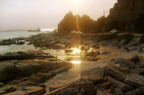
Photo: Ahumada.alejandra, CC BY-SA 4.0.
Las Ventanas is a Chilean city in Puchuncaví commune, Valparaíso Province, Valparaíso Region. Pop. 5,957.
Loncura
Suburb

Photo: René Cumplido, CC BY-SA 4.0.
Loncura is a suburb, which is situated 7 km south of Escuela La Chocota.
Quintero
Town

Photo: René Cumplido, CC BY-SA 4.0.
Quintero is a Chilean city and commune in Valparaíso Province, in the Valparaíso Region, 30 kilometers north of Valparaíso. The commune spans an area of 147.5 km2. Quintero is situated 7 km southwest of Escuela La Chocota.
Escuela La Chocota
- Type: School
- Address: 2680 Camino Horcón-Ventanas
- Category: education
- Location: Valparaíso Region, Chile, South America
- View on OpenStreetMap
Latitude
-32.72968° or 32° 43′ 47″ southLongitude
-71.48707° or 71° 29′ 14″ westOpen location code
47VC7GC7+45OpenStreetMap ID
way 1381832740OpenStreetMap feature
amenity=school
This page is based on OpenStreetMap, Wikidata, and Wikimedia Commons.
We’d love your help improving our open data sources. Thank you for contributing.
Satellite Map
Discover Escuela La Chocota from above in high-definition satellite imagery.
Notable Places Nearby
Highlights include Cancha Fútbol Horcón and Cancha Fútbol Horcón.
Nearby Places
Explore places such as Vulcanización and Almacén y Botillería Santa Julia.
Chile: Must-Visit Destinations
Delve into Central Chile, Santiago, Valparaíso, and Concepción.
Curious Schools to Discover
Uncover intriguing schools from every corner of the globe.
About Mapcarta. Data © OpenStreetMap contributors and available under the Open Database License". Text is available under the CC BY-SA 4.0 license, except for photos, directions, and the map. Photo: Gerardo Herrera, CC BY-SA 2.0.