Cleeve FC
Cleeve FC is a pitch in Bishop’s Cleeve, Tewkesbury, England. Cleeve FC is situated nearby to the dog park Cutbridge Meadow, as well as near Cleeve Cemetery.| Tap on a place to explore it |
Places of Interest Nearby
Highlights include Cleeve School and Church of the Ascension.
Cleeve School
School
Cleeve School is an academy school and a Leadership Partner School. It was formerly a comprehensive school and is located in the village of Bishop's Cleeve, Gloucestershire, England. Cleeve School is situated 1,500 feet northeast of Cleeve FC.
Church of the Ascension
Church

Photo: Griffp, CC BY-SA 4.0.
Church of the Ascension is situated 1 mile southeast of Cleeve FC.
Cheltenham Race Course railway station
Railway station

Photo: Jpilborough, CC BY-SA 3.0.
Cheltenham Race Course railway station serves Cheltenham Racecourse on the outskirts of Cheltenham, Gloucestershire, England. On the ex-Great Western Railway Cheltenham to Stratford line, the station opened in 1912 to serve the new racecourse at Prestbury Park, home of the famous Gold Cup meeting. Cheltenham Race Course railway station is situated 1 mile southwest of Cleeve FC.
Places in the Area
Nearby places include Bishop’s Cleeve and Woodmancote.
Bishop’s Cleeve
Town
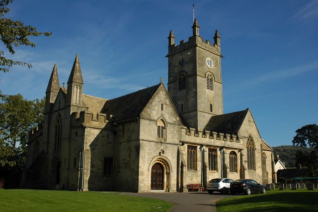
Photo: Philip Halling, CC BY-SA 2.0.
Bishop's Cleeve is a large village and civil parish in the Borough of Tewkesbury in the ceremonial county of Gloucestershire, England. The village lies at the foot of Cleeve Hill, the highest point in the Cotswolds.
Woodmancote
Village

Photo: Paul Higgins, CC BY-SA 2.0.
Woodmancote is a village and civil parish in Gloucestershire, England. The parish lies immediately east of Bishop's Cleeve; the village is about 3+1⁄2 miles north of Cheltenham.
Southam
Village
Photo: Griffp, CC BY-SA 4.0.
Southam is a village in Gloucestershire, England, located on the outskirts of Cheltenham. Its main features are a Manor House, which has now been converted to a hotel, a 12th Century Church and the Gloucestershire Warwickshire Railway, which runs through the outskirts of the village.
Cleeve FC
- Type: Pitch
- Categories: recreation area, football, and sports location
- Location: Bishop’s Cleeve, Tewkesbury, Gloucestershire, West Country, England, United Kingdom, Britain and Ireland, Europe
- View on OpenStreetMap
Latitude
51.93749° or 51° 56′ 15″ northLongitude
-2.058° or 2° 3′ 29″ westOpen location code
9C3VWWPR+XROpenStreetMap ID
way 1382113610OpenStreetMap feature
leisure=pitchOpenStreetMap feature
sport=soccer
This page is based on OpenStreetMap, Wikidata, and Wikimedia Commons.
We’d love your help improving our open data sources. Thank you for contributing.
Satellite Map
Discover Cleeve FC from above in high-definition satellite imagery.
Notable Places Nearby
Highlights include Cleeve FC and Cutbridge Meadow.
Nearby Places
Explore places such as Cleeve FC and Kayte Lane nr Delabere Rd.
Gloucestershire: Must-Visit Destinations
Delve into Gloucester, Cheltenham, Cirencester, and Yate.
Curious Pitches to Discover
Uncover intriguing pitches from every corner of the globe.
About Mapcarta. Data © OpenStreetMap contributors and available under the Open Database License". Text is available under the CC BY-SA 4.0 license, except for photos, directions, and the map. Photo: Matthew Hartley, CC BY-SA 2.0.