Moatamoy
Moatamoy is an archaeological site in County Wicklow, Leinster. Moatamoy is situated nearby to the ruins Saint Patrick’s Well, as well as near the town Baltinglass.| Tap on a place to explore it |
Places of Interest Nearby
Highlights include Crossoona Rath and Baltinglass Abbey.
Crossoona Rath
Archaeological site
Crossoona Rath is a ringfort located in County Wicklow, Ireland. Together with a nearby ogham stone, it forms a National Monument. Crossoona Rath is situated 3 km east of Moatamoy.
Baltinglass Abbey
Ruins

Photo: Digital Eye, CC BY-SA 4.0.
Baltinglass Abbey is a ruined medieval Cistercian abbey in Baltinglass, County Wicklow, Ireland. Founded by Diarmait Mac Murchada in 1148, the abbey was suppressed in 1536. It is today a National Monument. Baltinglass Abbey is situated 3½ km west of Moatamoy.
Places in the Area
Nearby places include Baltinglass and Kiltegan.
Baltinglass
Town

Photo: Sarah777, Public domain.
Baltinglass, historically known as Baltinglas, is a town in south-west County Wicklow, Ireland. It is located on the River Slaney near the border with County Carlow and County Kildare, on the N81 road. The town is in a civil parish of the same name. Baltinglass is situated 3½ km west of Moatamoy.
Kiltegan
Village

Photo: Davidparsons, Public domain.
Kiltegan is a village in west County Wicklow, Ireland, on the R747 regional road close to the border with County Carlow. The village is in a townland and civil parish of the same name. Kiltegan is situated 5 km southeast of Moatamoy.
Stratford
Village
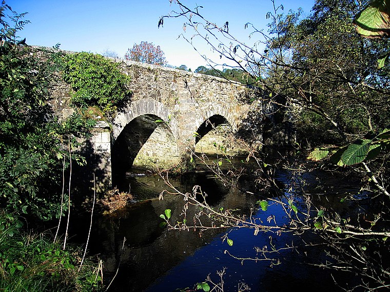
Photo: Sarah777, Public domain.
Stratford-on-Slaney, also known as Stratford or Stratford-upon-Slaney, is a small village on the River Slaney in west County Wicklow in Ireland. It was built by the Earl of Aldborough from 1774. According to the census, the village had a population of 241. Stratford is situated 6 km north of Moatamoy.
Moatamoy
- Type: Archaeological site
- Categories: historic site, tourist attraction, and tourism
- Location: County Wicklow, Leinster, East Coast and Midlands, Ireland, Britain and Ireland, Europe
- View on OpenStreetMap
Latitude
52.93906° or 52° 56′ 21″ northLongitude
-6.65559° or 6° 39′ 20″ westOpen location code
9C4MW8QV+JQOpenStreetMap ID
way 1382308325OpenStreetMap feature
historic=archaeological_site
This page is based on OpenStreetMap, Wikidata, and Wikimedia Commons.
We’d love your help improving our open data sources. Thank you for contributing.
Satellite Map
Discover Moatamoy from above in high-definition satellite imagery.
Notable Places Nearby
Highlights include Saint Patrick’s Well and Kilranelagh Graveyard.
Nearby Places
Explore places such as Kilranelagh House and Sam McAllistair Grave.
County Wicklow: Must-Visit Destinations
Delve into Bray, Wicklow Town, Arklow, and Glendalough.
Curious Archaeological Sites to Discover
Uncover intriguing archaeological sites from every corner of the globe.
About Mapcarta. Data © OpenStreetMap contributors and available under the Open Database License". Text is available under the CC BY-SA 4.0 license, except for photos, directions, and the map. Photo: Wikimedia, CC BY-SA 3.0.