Ferme Peeters-Vandenschrick
Ferme Peeters-Vandenschrick is a farm in Durbuy, Arrondissement of Marche-en-Famenne, Wallonia. Ferme Peeters-Vandenschrick is situated nearby to the church Chapelle Sainte-Madeleine, as well as near Chapelle Saint-Hubert.| Tap on a place to explore it |
Places of Interest Nearby
Highlights include Church of Saint Remaclus and Tornaco Castle.
Church of Saint Remaclus
Church

Photo: EmDee, CC BY-SA 3.0.
The Church of Saint Remaclus is a Romanesque church in Ocquier, a district of the municipality of Clavier in Belgium. It is dedicated to Saint Remaclus. Church of Saint Remaclus is situated 2½ km southwest of Ferme Peeters-Vandenschrick.
Tornaco Castle
Castle
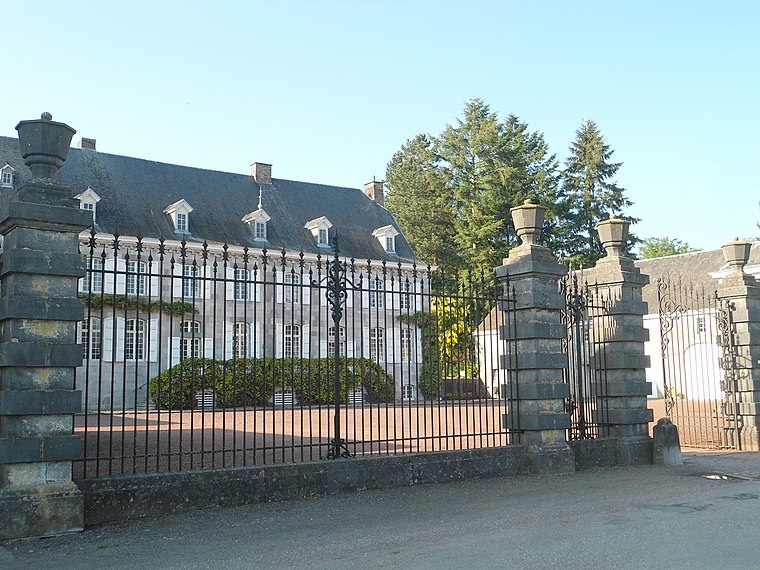
Photo: Rebexho, CC BY-SA 4.0.
Tornaco Castle is a castle in Vervoz, in the municipality of Clavier, Belgium. Tornaco Castle is situated 3½ km southwest of Ferme Peeters-Vandenschrick.
Places in the Area
Nearby places include Jenneret and Ocquier.

Ocquier
Village

Photo: Jean-Pol GRANDMONT, CC BY-SA 3.0.
Ocquier is a district of the municipality of Clavier, in the province of Liège in Wallonia, Belgium. The history of the village goes back to Roman times, when it was an important colony on the road between Cologne and Reims. Ocquier is situated 2½ km southwest of Ferme Peeters-Vandenschrick.
Oneux
Hamlet

Photo: Jeanhousen, CC BY 3.0.
Oneux is a hamlet, which is situated 3 km southeast of Ferme Peeters-Vandenschrick.
Ferme Peeters-Vandenschrick
- Type: Farm
- Category: agriculture
- Location: Durbuy, Arrondissement of Marche-en-Famenne, Luxembourg, Wallonia, Belgium, Benelux, Europe
- View on OpenStreetMap
Latitude
50.41773° or 50° 25′ 4″ northLongitude
5.4125° or 5° 24′ 45″ eastOpen location code
9F27CC97+32OpenStreetMap ID
way 1382762709OpenStreetMap feature
landuse=farmyard
This page is based on OpenStreetMap, Wikidata, and Wikimedia Commons.
We’d love your help improving our open data sources. Thank you for contributing.
Satellite Map
Discover Ferme Peeters-Vandenschrick from above in high-definition satellite imagery.
Notable Places Nearby
Highlights include Chapelle Sainte-Madeleine and Chapelle Saint-Hubert.
Nearby Places
Explore places such as Bende Voie Romaine and Vieille Chapelle.
Luxembourg: Must-Visit Destinations
Delve into Arlon, Bastogne, Bouillon, and La Roche-en-Ardenne.
Curious Farms to Discover
Uncover intriguing farms from every corner of the globe.
About Mapcarta. Data © OpenStreetMap contributors and available under the Open Database License". Text is available under the CC BY-SA 4.0 license, except for photos, directions, and the map. Photo: Inkey, CC BY-SA 3.0.