Käthe Dassler Realschule plus
Käthe Dassler Realschule plus is a school in Pirmasens, Palatinate, Rhineland-Palatinate which is located on Kirchbergstraße. Käthe Dassler Realschule plus is situated nearby to the sports venue Kirchberghalle, as well as near the post office Hermes Paketshop.| Tap on a place to explore it |
- Type: School
- Address: Kirchbergstraße 41, Pirmasens, 66955
- Wheelchair access: limited
Places of Interest Nearby
Highlights include Festhalle Pirmasens and Lutherkirche in Pirmasens.
Festhalle Pirmasens
Theater building
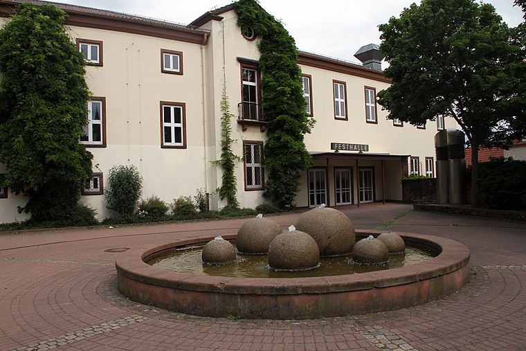
Photo: Gerd Eichmann, CC BY-SA 3.0.
Festhalle Pirmasens is a theater building, which is situated 510 metres northeast of Käthe Dassler Realschule plus.
Lutherkirche in Pirmasens
Church

Photo: Wikimedia, CC BY-SA 2.5.
Lutherkirche in Pirmasens is a church, which is situated 1 km north of Käthe Dassler Realschule plus.
Zion’s church in Pirmasens
Church

Photo: Gerd Eichmann, CC BY-SA 3.0.
Zion’s church in Pirmasens is situated 1 km north of Käthe Dassler Realschule plus.
Places in the Area
Nearby places include Niedersimten and Winzeln.

Winzeln
Suburb

Photo: Gerd Eichmann, CC BY-SA 4.0.
Winzeln is a suburb, which is situated 3 km west of Käthe Dassler Realschule plus.
Obersimten
Village
Obersimten is a municipality in Südwestpfalz district, in Rhineland-Palatinate, western Germany and belongs to the municipal association Pirmasens-Land. Obersimten is situated 3 km southwest of Käthe Dassler Realschule plus.
Käthe Dassler Realschule plus
- Category: education
- Location: Pirmasens, Palatinate, Rhineland-Palatinate, Germany, Central Europe, Europe
- View on OpenStreetMap
Latitude
49.19051° or 49° 11′ 26″ northLongitude
7.60685° or 7° 36′ 25″ eastOpen location code
8FX95JR4+6POpenStreetMap ID
way 1385497849OpenStreetMap feature
amenity=schoolOpenStreetMap attribute
wheelchair=limited
This page is based on OpenStreetMap, Wikidata, and Wikimedia Commons.
We’d love your help improving our open data sources. Thank you for contributing.
Satellite Map
Discover Käthe Dassler Realschule plus from above in high-definition satellite imagery.
Notable Places Nearby
Highlights include Kirchberghalle and Hermes Paketshop.
Nearby Places
Explore places such as Pirmasens Kirchbergstraße and IG SCHIFFSMODELLBAU PIRMASENS E.V. / Pfadfindergruppe e.V. Pirmasens / Seniorenbüro Haus Meinberg.
Palatinate: Must-Visit Destinations
Delve into Ludwigshafen, Speyer, Kaiserslautern, and Landau in der Pfalz.
Curious Schools to Discover
Uncover intriguing schools from every corner of the globe.
About Mapcarta. Data © OpenStreetMap contributors and available under the Open Database License". Text is available under the CC BY-SA 4.0 license, except for photos, directions, and the map. Photo: Wikimedia, CC0.