Freibad Schönberg
Freibad Schönberg is a water park in Schönberg am Kamp, Krems District, Lower Austria. Freibad Schönberg is situated nearby to the swimming pool Kinderbecken, as well as near the winery Gerhard Deim.| Tap on a place to explore it |
Places of Interest Nearby
Highlights include Pfarrkirche Schönberg am Kamp and Schönberg am Kamp station.
Pfarrkirche Schönberg am Kamp
Church

Photo: Bwag, CC BY-SA 3.0 at.
Pfarrkirche Schönberg am Kamp is a church, which is situated 460 metres southeast of Freibad Schönberg.
Schönberg am Kamp station
Railway station

Photo: Priwo, Public domain.
Schönberg am Kamp station is a railway station, which is situated 710 metres south of Freibad Schönberg.
Kronabetter-Haus
Building

Photo: WA-Wien, CC BY-SA 3.0.
Kronabetter-Haus is a building, which is situated 390 metres southeast of Freibad Schönberg.
Places in the Area
Nearby places include Zöbing and Freischling.
Zöbing
Village

Photo: Maclemo, CC BY-SA 4.0.
Zöbing is a village, which is situated 3½ km south of Freibad Schönberg.
Freischling
Village
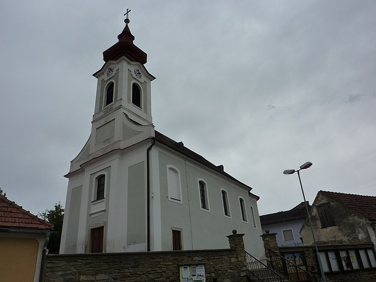
Photo: BSonne, CC BY-SA 3.0.
Freischling is a village, which is situated 5 km north of Freibad Schönberg.
Langenlois
Town

Photo: Isiwal, CC BY-SA 4.0.
Langenlois is a town at the Kamp river in the Kamptal, district of Krems-Land in the Austrian state of Lower Austria. Famous for its wine production, it is also home to the Loisium, a centre celebrating and advertising the local wine and built by the American deconstructionist architect Steven Holl. Langenlois is situated 6 km south of Freibad Schönberg.
Freibad Schönberg
- Type: Water park
- Categories: recreation area, tourist attraction, and tourism
- Location: Schönberg am Kamp, Krems District, Lower Austria, Austria, Central Europe, Europe
- View on OpenStreetMap
Latitude
48.5218° or 48° 31′ 19″ northLongitude
15.69443° or 15° 41′ 40″ eastOpen location code
8FWQGMCV+PQOpenStreetMap ID
way 138972261OpenStreetMap feature
landuse=recreation_groundOpenStreetMap feature
leisure=water_park
This page is based on OpenStreetMap, Wikidata, and Wikimedia Commons.
We’d love your help improving our open data sources. Thank you for contributing.
Satellite Map
Discover Freibad Schönberg from above in high-definition satellite imagery.
Notable Places Nearby
Highlights include Kinderbecken and Gerhard Deim.
Nearby Places
Explore places such as Badbuffet and Altes Badhaus.
Lower Austria: Must-Visit Destinations
Delve into St. Pölten, Wiener Neustadt, Amstetten, and Klosterneuburg.
Curious Water Parks to Discover
Uncover intriguing water parks from every corner of the globe.
About Mapcarta. Data © OpenStreetMap contributors and available under the Open Database License". Text is available under the CC BY-SA 4.0 license, except for photos, directions, and the map. Photo: Lonezor, CC BY-SA 3.0.