Mary Casey Black Elementary School
Mary Casey Black Elementary School is a school in Contra Costa, California. Mary Casey Black Elementary School is situated nearby to Live Oak Park, as well as near Sycamore Park.| Tap on a place to explore it |
Places of Interest Nearby
Highlights include Liberty High School.
Liberty High School
School
Liberty High School is located in Brentwood, California, United States. It is a comprehensive 9–12 grade high school serving approximately 2800 students. It was founded in 1902 as Liberty Union High School. Liberty High School is situated 1 mile south of Mary Casey Black Elementary School.
Places in the Area
Nearby places include Brentwood and Sand Hill.
Brentwood
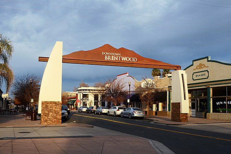 Brentwood is an affluent, suburban city in eastern Contra Costa County, California with a popular downtown for visitors coming from the Sacramento Valley to the county.
Sand Hill
Hamlet
Sand Hill is a former unincorporated community now annexed to Oakley in Contra Costa County, California. It lies at an elevation of 43 feet. It is west of Knightsten on the far edge of the county. Sand Hill is situated 2 miles north of Mary Casey Black Elementary School.
Knightsen
Village
Knightsen is a census-designated place in Contra Costa County, California, United States. As of the 2020 census, the CDP population was 1,596. Knightsen is situated 2 miles northeast of Mary Casey Black Elementary School.
Mary Casey Black Elementary School
- Type: School
- Category: education
- Location: Contra Costa, California, United States, North America
- View on OpenStreetMap
Latitude
37.94796° or 37° 56′ 53″ northLongitude
-121.68833° or 121° 41′ 18″ westOpen location code
849WW8X6+5MOpenStreetMap ID
way 1391528188OpenStreetMap feature
amenity=school
This page is based on OpenStreetMap, Wikidata, and Wikimedia Commons.
We’d love your help improving our open data sources. Thank you for contributing.
Satellite Map
Discover Mary Casey Black Elementary School from above in high-definition satellite imagery.
Notable Places Nearby
Highlights include Live Oak Park and Sycamore Park.
Nearby Places
Explore places such as Terrene and Havenwood Village.
California: Must-Visit Destinations
Delve into San Francisco, Los Angeles, San Diego, and Sacramento.
Curious Schools to Discover
Uncover intriguing schools from every corner of the globe.
About Mapcarta. Data © OpenStreetMap contributors and available under the Open Database License". Text is available under the CC BY-SA 4.0 license, except for photos, directions, and the map. Photo: Wikimedia, CC0.